Bácsalmás night lights from space
Night Light of Bácsalmás (Bács-Kiskun) from space (Hungary) Src. Average luminocity for 10x10km area is 1.9148% and for 50x50km: 2.5323%.
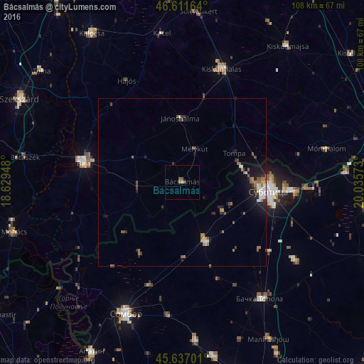
Analysis of Bácsalmás night lights 2016
Square area 10x10 km:
 0%
0%90-99
0%80-89
0%70-79
0.57%60-69
0.57%50-59
1.42%40-49
0.28%30-39
0%20-29
0%10-19
0%0-9
97.16%Square area 50x50 km:
0.21%90-99
0.37%80-89
0.15%70-79
0.27%60-69
0.49%50-59
0.58%40-49
0.34%30-39
0.26%20-29
0.77%10-19
1.66%0-9
94.89%Clear (daylight) street map image can be seen on geolist.org.
Map coordinates:
46° 36' 41.9" North, 18° 37' 46.1" East
46° 7' 35.3" North, 19° 19' 57.4" East
45° 38' 13.2" North, 20° 2' 8.6" East
Some cities around Bácsalmás sort by population:
• Subotica, RS
25.9 km =16.1 mi,  96°
96°
• Sombor, RS
42.7 km =26.5 mi,  203°
203°
• Baja
29.9 km =18.6 mi,  282°
282°
• Kiskunhalas
36.1 km =22.4 mi,  18°
18°
• Bačka Topola, RS
41.6 km =25.8 mi,  146°
146°
• Jánoshalma
19.1 km =11.9 mi,  358°
358°
• Mélykút
10.5 km =6.5 mi, 20°
• Stanišić, RS
24.5 km =15.2 mi,  211°
211°
3055760 (p: 7,608)
Sources (retrieved 2019-11-25):
» Earth at Night: Flat Maps 2012, 2016