Osijek night lights from space
Night Light of Osijek (Osječko-Baranjska) from space (Croatia) Src. Average luminocity for 10x10km area is 48.4606% and for 50x50km: 6.8927%.
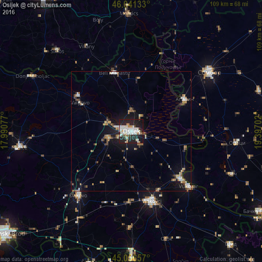
Analysis of Osijek night lights 2016
Square area 10x10 km:
 12.42%
90-99
15.91%80-89
3.18%70-79
4.24%60-69
1.52%50-59
1.97%40-49
2.73%30-39
2.58%20-29
28.64%10-19
25.61%0-9
1.21%Square area 50x50 km:
0.87%90-99
1.15%80-89
0.76%70-79
0.72%60-69
0.75%50-59
0.95%40-49
0.79%30-39
0.77%20-29
1.86%10-19
5.72%0-9
85.67%Clear (daylight) street map image can be seen on geolist.org.
Map coordinates:
46° 2' 28.8" North, 17° 59' 26.8" East
45° 33' 4" North, 18° 41' 38" East
45° 3' 23.7" North, 19° 23' 49.3" East
Some cities around Osijek sort by population:
• Apatin, RS
25.9 km =16.1 mi,  58°
58°
• Čepin
10.6 km =6.6 mi,  253°
253°
• Beli Manastir
25.3 km =15.7 mi,  343°
343°
• Valpovo
24.6 km =15.3 mi,  299°
299°
• Tenja
7.2 km =4.5 mi,  144°
144°
• Belišće
26.6 km =16.5 mi, 302°
• Višnjevac
6.5 km =4 mi,  287°
287°
• Darda
8.6 km =5.3 mi,  3°
3°
3193935 (p: 88,140)
Sources (retrieved 2019-11-25):
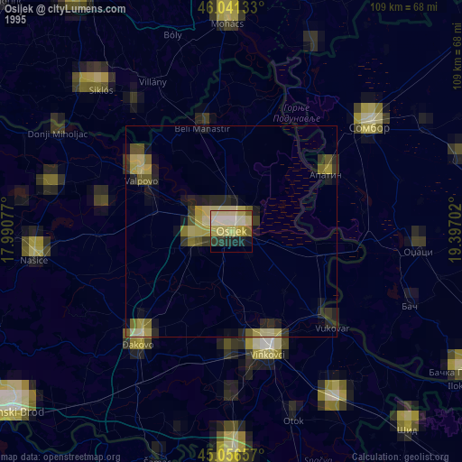
» NASA, Earths city lights 1995
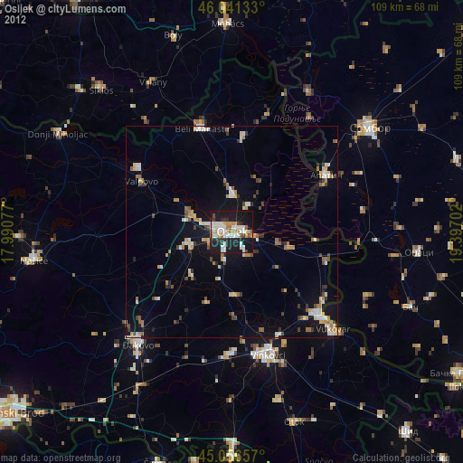
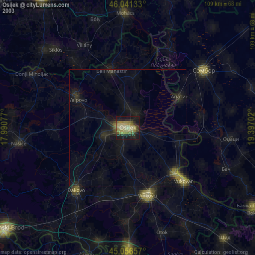
» NASA city lights 2003
» Earth at Night: Flat Maps 2012, 2016