Şiria night lights from space
Night Light of Şiria (Arad) from space (Romania) Src. Average luminocity for 10x10km area is 0.6637% and for 50x50km: 3.0736%.
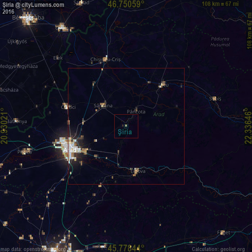
Analysis of Şiria night lights 2016
Square area 10x10 km:
100  0%
0%
90-99 0%
80-89 0%
70-79 0%
60-69 0.6%
50-59 0%
40-49 0%
30-39 0%
20-29 0.6%
10-19 0%
0-9 98.81%
0%90-99
0%80-89
0%70-79
0%60-69
0.6%50-59
0%40-49
0%30-39
0%20-29
0.6%10-19
0%0-9
98.81%Square area 50x50 km:
100 0.41%
90-99 0.62%
80-89 0.32%
70-79 0.18%
60-69 0.29%
50-59 0.56%
40-49 0.4%
30-39 0.46%
20-29 1.2%
10-19 1.76%
0-9 93.8%
0.41%90-99
0.62%80-89
0.32%70-79
0.18%60-69
0.29%50-59
0.56%40-49
0.4%30-39
0.46%20-29
1.2%10-19
1.76%0-9
93.8%Clear (daylight) street map image can be seen on geolist.org.
Map coordinates:
46° 45' 2.1" North, 20° 55' 48.8" East
46° 16' 0" North, 21° 37' 60" East
45° 46' 42.4" North, 22° 20' 11.3" East
Some cities around Şiria sort by population:
• Arad
26.1 km =16.2 mi,  249°
249°
• Sântana
13.8 km =8.6 mi,  312°
312°
• Lipova
20.1 km =12.5 mi,  166°
166°
• Vladimirescu
21.1 km =13.1 mi,  238°
238°
• Ineu
24.4 km =15.2 mi,  40°
40°
• Pâncota
9 km =5.6 mi,  34°
34°
• Târnova
14 km =8.7 mi,  66°
66°
• Fântânele
24.9 km =15.5 mi,  230°
230°
666821 (p: 8,004)
Sources (retrieved 2019-11-25):
» Earth at Night: Flat Maps 2012, 2016