Sântana night lights from space
Night Light of Sântana (Arad) from space (Romania) Src. Average luminocity for 10x10km area is 3.6711% and for 50x50km: 4.4131%.
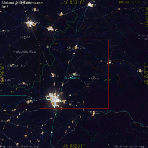
Analysis of Sântana night lights 2016
Square area 10x10 km:
 0%
0%90-99
0%80-89
0.6%70-79
1.19%60-69
0.74%50-59
0.45%40-49
0.6%30-39
0.89%20-29
1.49%10-19
0.6%0-9
93.45%Square area 50x50 km:
0.77%90-99
0.98%80-89
0.47%70-79
0.32%60-69
0.43%50-59
0.52%40-49
0.35%30-39
0.68%20-29
1.75%10-19
2.44%0-9
91.3%Clear (daylight) street map image can be seen on geolist.org.
Map coordinates:
46° 49' 59.4" North, 20° 47' 48.8" East
46° 21' 0" North, 21° 30' 0" East
45° 51' 45" North, 22° 12' 11.3" East
Some cities around Sântana sort by population:
• Arad
23.3 km =14.5 mi,  217°
217°
• Vladimirescu
21.8 km =13.5 mi,  200°
200°
• Curtici
15.3 km =9.5 mi,  270°
270°
• Chişineu-Criş
19.5 km =12.1 mi,  4°
4°
• Şiria
13.8 km =8.6 mi,  132°
132°
• Pâncota
15.5 km =9.6 mi,  96°
96°
• Târnova
23.3 km =14.5 mi, 99°
• Macea
15.8 km =9.8 mi,  283°
283°
666936 (p: 12,706)
Sources (retrieved 2019-11-25):
» Earth at Night: Flat Maps 2012, 2016