Întorsura Buzăului night lights from space
Night Light of Întorsura Buzăului (Covasna) from space (Romania) Src. Average luminocity for 10x10km area is 1.3091% and for 50x50km: 1.7071%.
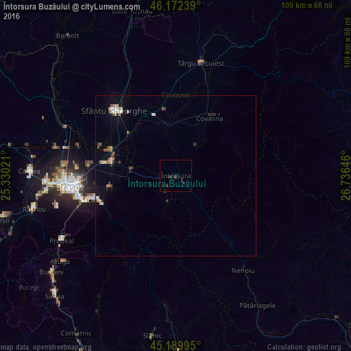
Analysis of Întorsura Buzăului night lights 2016
Square area 10x10 km:
 0%
0%90-99
0%80-89
0%70-79
0%60-69
0%50-59
0%40-49
0.15%30-39
1.82%20-29
1.82%10-19
0.15%0-9
96.06%Square area 50x50 km:
0.2%90-99
0.25%80-89
0.17%70-79
0.11%60-69
0.26%50-59
0.2%40-49
0.19%30-39
0.31%20-29
0.27%10-19
0.69%0-9
97.34%Clear (daylight) street map image can be seen on geolist.org.
Map coordinates:
46° 10' 20.6" North, 25° 19' 48.8" East
45° 40' 60" North, 26° 1' 60" East
45° 11' 23.8" North, 26° 44' 11.3" East
Some cities around Întorsura Buzăului sort by population:
• Braşov
33.4 km =20.8 mi,  263°
263°
• Sfântu Gheorghe
28.1 km =17.5 mi,  316°
316°
• Săcele
26.1 km =16.2 mi,  253°
253°
• Târgu Secuiesc
36.1 km =22.4 mi,  12°
12°
• Covasna
21.9 km =13.6 mi,  32°
32°
• Prejmer
21 km =13 mi,  280°
280°
• Tărlungeni
22.7 km =14.1 mi, 255°
• Zagon
11.3 km =7 mi, 34°
675585 (p: 9,026)
Sources (retrieved 2019-11-25):
» Earth at Night: Flat Maps 2012, 2016