Covasna night lights from space
Night Light of Covasna from space (Romania) Src. Average luminocity for 10x10km area is 0.6905% and for 50x50km: 0.2691%.
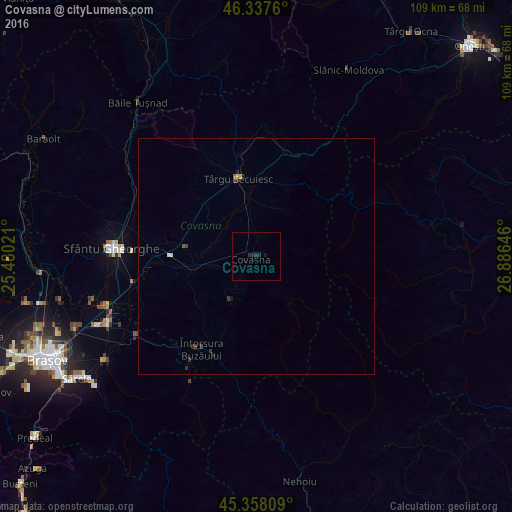
Analysis of Covasna night lights 2016
Square area 10x10 km:
 0%
0%90-99
0%80-89
0%70-79
0%60-69
0%50-59
0%40-49
0%30-39
0%20-29
1.79%10-19
1.19%0-9
97.02%Square area 50x50 km:
0.04%90-99
0.01%80-89
0%70-79
0.05%60-69
0%50-59
0.05%40-49
0.06%30-39
0.11%20-29
0.19%10-19
0.1%0-9
99.39%Clear (daylight) street map image can be seen on geolist.org.
Map coordinates:
46° 20' 15.4" North, 25° 28' 48.8" East
45° 51' 0" North, 26° 10' 60" East
45° 21' 29.1" North, 26° 53' 11.3" East
Some cities around Covasna sort by population:
• Sfântu Gheorghe
31 km =19.3 mi,  273°
273°
• Săcele
44.9 km =27.9 mi,  234°
234°
• Târgu Secuiesc
17.1 km =10.6 mi,  346°
346°
• Întorsura Buzăului
21.9 km =13.6 mi,  212°
212°
• Prejmer
35.5 km =22.1 mi,  245°
245°
• Tărlungeni
41.4 km =25.7 mi, 234°
• Tulnici
38.1 km =23.7 mi,  78°
78°
• Zagon
10.6 km =6.6 mi, 209°
680430 (p: 10,979)
Sources (retrieved 2019-11-25):
» Earth at Night: Flat Maps 2012, 2016