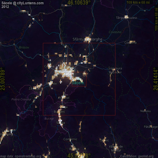
Săcele night lights from space
Night Light of Săcele (Braşov) from space (Romania) Src. Average luminocity for 10x10km area is 23.7273% and for 50x50km: 7.3387%.
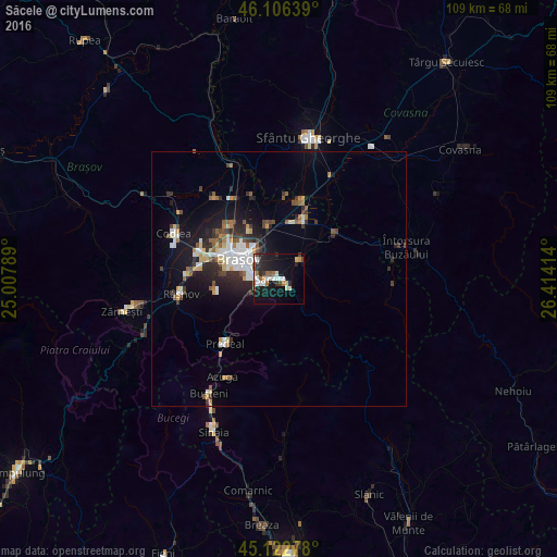
Analysis of Săcele night lights 2016
Square area 10x10 km:
100  3.94%
3.94%
90-99 4.85%
80-89 1.67%
70-79 1.21%
60-69 2.58%
50-59 3.03%
40-49 1.82%
30-39 2.58%
20-29 9.55%
10-19 25.45%
0-9 43.33%
3.94%90-99
4.85%80-89
1.67%70-79
1.21%60-69
2.58%50-59
3.03%40-49
1.82%30-39
2.58%20-29
9.55%10-19
25.45%0-9
43.33%Square area 50x50 km:
100 1.42%
90-99 1.07%
80-89 0.62%
70-79 0.7%
60-69 0.62%
50-59 1.04%
40-49 0.9%
30-39 1.02%
20-29 2.23%
10-19 5.33%
0-9 85.06%
1.42%90-99
1.07%80-89
0.62%70-79
0.7%60-69
0.62%50-59
1.04%40-49
0.9%30-39
1.02%20-29
2.23%10-19
5.33%0-9
85.06%Clear (daylight) street map image can be seen on geolist.org.
Map coordinates:
46° 6' 23" North, 25° 0' 28.4" East
45° 37' 0.3" North, 25° 42' 39.6" East
45° 7' 22" North, 26° 24' 50.9" East
Some cities around Săcele sort by population:
• Braşov
8.9 km =5.5 mi,  293°
293°
• Codlea
22.3 km =13.9 mi, 294°
• Râşnov
20.6 km =12.8 mi,  259°
259°
• Prejmer
11.9 km =7.4 mi,  21°
21°
• Tărlungeni
3.5 km =2.2 mi,  58°
58°
• Hălchiu
20.8 km =12.9 mi,  323°
323°
• Predeal
17.2 km =10.7 mi,  220°
220°
• Vulcan
23 km =14.3 mi,  274°
274°
668314 (p: 29,918)
Sources (retrieved 2019-11-25):
» Earth at Night: Flat Maps 2012, 2016