Tărlungeni night lights from space
Night Light of Tărlungeni (Braşov) from space (Romania) Src. Average luminocity for 10x10km area is 12.9924% and for 50x50km: 7.3813%.
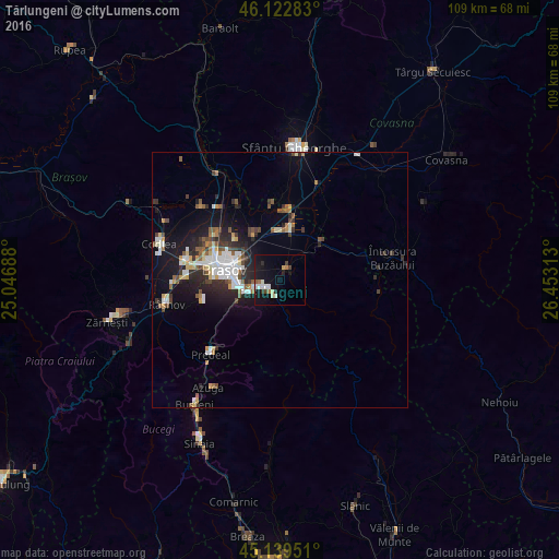
Analysis of Tărlungeni night lights 2016
Square area 10x10 km:
 1.52%
1.52%90-99
2.73%80-89
1.36%70-79
0.61%60-69
1.67%50-59
0.61%40-49
1.21%30-39
1.21%20-29
1.67%10-19
18.64%0-9
68.79%Square area 50x50 km:
1.46%90-99
1.09%80-89
0.63%70-79
0.67%60-69
0.64%50-59
1.05%40-49
0.9%30-39
1.03%20-29
2.26%10-19
5.43%0-9
84.84%Clear (daylight) street map image can be seen on geolist.org.
Map coordinates:
46° 7' 22.2" North, 25° 2' 48.8" East
45° 37' 60" North, 25° 45' 0" East
45° 8' 22.2" North, 26° 27' 11.3" East
Some cities around Tărlungeni sort by population:
• Braşov
11.3 km =7 mi,  278°
278°
• Săcele
3.5 km =2.2 mi,  238°
238°
• Râşnov
24 km =14.9 mi,  256°
256°
• Întorsura Buzăului
22.7 km =14.1 mi,  75°
75°
• Prejmer
9.4 km =5.8 mi,  7°
7°
• Feldioara
23.5 km =14.6 mi,  330°
330°
• Hălchiu
21.5 km =13.4 mi,  313°
313°
• Predeal
20.6 km =12.8 mi,  223°
223°
665497 (p: 7,219)
Sources (retrieved 2019-11-25):
» Earth at Night: Flat Maps 2012, 2016