Bocşa night lights from space
Night Light of Bocşa (Caraş-Severin) from space (Romania) Src. Average luminocity for 10x10km area is 3.8857% and for 50x50km: 1.3448%.
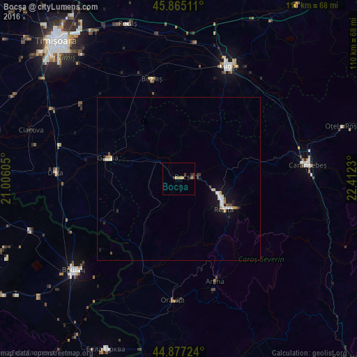
Analysis of Bocşa night lights 2016
Square area 10x10 km:
 0%
0%90-99
0%80-89
0.95%70-79
0.95%60-69
0.63%50-59
0.63%40-49
0.63%30-39
1.9%20-29
0.63%10-19
0.63%0-9
93.02%Square area 50x50 km:
0.19%90-99
0.27%80-89
0.13%70-79
0.21%60-69
0.04%50-59
0.12%40-49
0.16%30-39
0.17%20-29
0.18%10-19
0.98%0-9
97.57%Clear (daylight) street map image can be seen on geolist.org.
Map coordinates:
45° 51' 54.4" North, 21° 0' 21.8" East
45° 22' 24" North, 21° 42' 33" East
44° 52' 38.1" North, 22° 24' 44.3" East
Some cities around Bocşa sort by population:
• Reşiţa
16.2 km =10.1 mi,  119°
119°
• Lugoj
38.2 km =23.7 mi,  23°
23°
• Caransebeş
39.9 km =24.8 mi,  83°
83°
• Oraviţa
37.9 km =23.5 mi,  182°
182°
• Anina
34.7 km =21.6 mi,  160°
160°
• Gătaia
22.7 km =14.1 mi,  286°
286°
• Buziaş
31.8 km =19.8 mi,  344°
344°
• Deta
37.9 km =23.5 mi,  272°
272°
684490 (p: 16,349)
Sources (retrieved 2019-11-25):
» Earth at Night: Flat Maps 2012, 2016