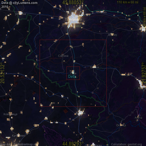
Deta night lights from space
Night Light of Deta (Timiş) from space (Romania) Src. Average luminocity for 10x10km area is 4.0476% and for 50x50km: 1.0915%.
Analysis of Deta night lights 2016
Square area 10x10 km:
 0.32%
0.32%90-99
0.32%80-89
0.63%70-79
0.95%60-69
0.32%50-59
0.79%40-49
0.48%30-39
0.63%20-29
1.9%10-19
0%0-9
93.65%Square area 50x50 km:
0.04%90-99
0.12%80-89
0.08%70-79
0.13%60-69
0.17%50-59
0.25%40-49
0.36%30-39
0.18%20-29
0.37%10-19
0.23%0-9
98.07%Clear (daylight) street map image can be seen on geolist.org.
Map coordinates:
45° 52' 49.9" North, 20° 31' 16.8" East
45° 23' 20" North, 21° 13' 28" East
44° 53' 34.5" North, 21° 55' 39.3" East
Some cities around Deta sort by population:
• Timişoara
40.6 km =25.2 mi,  0°
0°
• Vršac, RS
30.9 km =19.2 mi,  168°
168°
• Bocşa
37.9 km =23.5 mi,  92°
92°
• Gătaia
16.7 km =10.4 mi,  73°
73°
• Buziaş
41.4 km =25.7 mi,  45°
45°
• Ciacova
15.2 km =9.4 mi,  330°
330°
• Banatski Karlovac, RS
41 km =25.5 mi,  203°
203°
• Jebel
18.6 km =11.6 mi,  357°
357°
679456 (p: 6,252)
Sources (retrieved 2019-11-25):
» Earth at Night: Flat Maps 2012, 2016