Tobatí night lights from space
Night Light of Tobatí (Cordillera) from space (Paraguay) Src. Average luminocity for 10x10km area is 15.2004% and for 50x50km: 11.5111%.
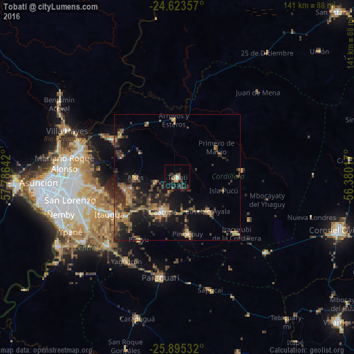
Analysis of Tobatí night lights 2016
Square area 10x10 km:
 1.39%
1.39%90-99
0.2%80-89
0.99%70-79
2.18%60-69
3.17%50-59
0.79%40-49
2.98%30-39
6.15%20-29
4.76%10-19
11.9%0-9
65.48%Square area 50x50 km:
0.32%90-99
0.25%80-89
1.4%70-79
1.92%60-69
2.66%50-59
1.69%40-49
2.8%30-39
3.2%20-29
4.32%10-19
8.55%0-9
72.87%Clear (daylight) street map image can be seen on geolist.org.
Map coordinates:
24° 37' 24.9" South, 57° 47' 11.1" West
25° 15' 40" South, 57° 4' 59.8" West
25° 53' 43.2" South, 56° 22' 48.6" West
Some cities around Tobatí sort by population:
• Capiatá
37.9 km =23.5 mi,  253°
253°
• Itauguá
30.9 km =19.2 mi,  241°
241°
• Caacupé
15.1 km =9.4 mi,  203°
203°
• Areguá
30.8 km =19.1 mi,  259°
259°
• Piribebuy
23 km =14.3 mi,  169°
169°
• Ypacarai
26.3 km =16.3 mi,  231°
231°
• Eusebio Ayala
18.3 km =11.4 mi,  137°
137°
• Emboscada
29.5 km =18.3 mi,  294°
294°
3436812 (p: 9,952)
Sources (retrieved 2019-11-25):
» Earth at Night: Flat Maps 2012, 2016