Viana do Castelo night lights from space
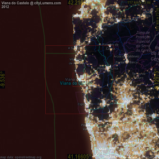
Night Light of Viana do Castelo from space (Portugal) Src. Average luminocity for 10x10km area is 41.6753% and for 50x50km: 17.6626%.
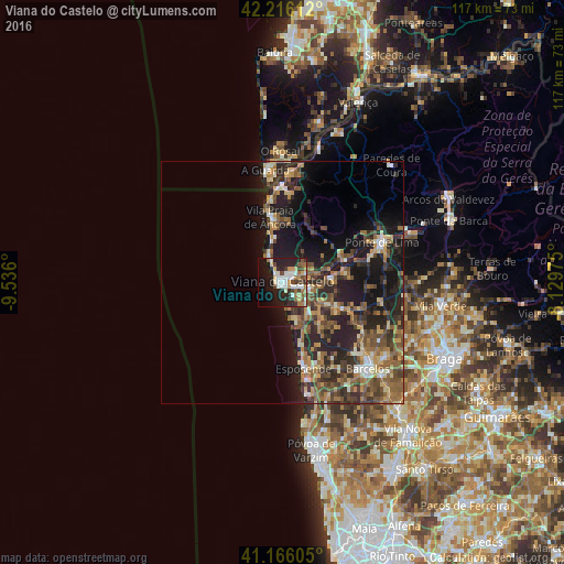
Analysis of Viana do Castelo night lights 2016
Square area 10x10 km:
 7.79%
7.79%90-99
9.09%80-89
5.03%70-79
2.76%60-69
6.66%50-59
3.9%40-49
6.82%30-39
4.22%20-29
17.69%10-19
21.27%0-9
14.77%Square area 50x50 km:
0.91%90-99
2.18%80-89
2.15%70-79
2.24%60-69
3.28%50-59
3.76%40-49
3.89%30-39
3.46%20-29
7.77%10-19
12.12%0-9
58.24%Clear (daylight) street map image can be seen on geolist.org.
Map coordinates:
42° 12' 58" North, 9° 32' 9.6" West
41° 41' 35.6" North, 8° 49' 58.3" West
41° 9' 57.8" North, 8° 7' 47.1" West
Some cities around Viana do Castelo sort by population:
• Ponte de Lima
22.2 km =13.8 mi,  68°
68°
• Esposende
18 km =11.2 mi,  166°
166°
• Barcelos
25.3 km =15.7 mi,  135°
135°
• Meadela
3.4 km =2.1 mi,  64°
64°
• Darque
5.6 km =3.5 mi,  101°
101°
• Apúlia e Fão
20.8 km =12.9 mi, 166°
• Marinhas
15.5 km =9.6 mi,  164°
164°
• Galegos
26.1 km =16.2 mi,  123°
123°
2732773 (p: 36,148)
Sources (retrieved 2019-11-25):
» Earth at Night: Flat Maps 2012, 2016