Esposende night lights from space
Night Light of Esposende (Braga) from space (Portugal) Src. Average luminocity for 10x10km area is 37.8639% and for 50x50km: 29.6483%.
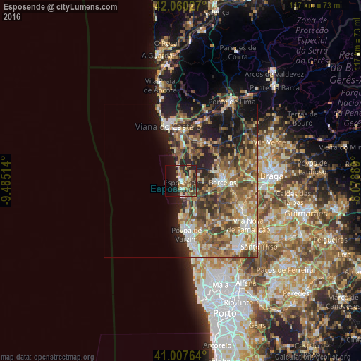
Analysis of Esposende night lights 2016
Square area 10x10 km:
 2.04%
2.04%90-99
4.42%80-89
6.63%70-79
7.48%60-69
7.82%50-59
6.46%40-49
6.63%30-39
5.61%20-29
14.12%10-19
19.56%0-9
19.22%Square area 50x50 km:
2.57%90-99
5.06%80-89
4.15%70-79
3.96%60-69
6.71%50-59
6.73%40-49
5.61%30-39
5.01%20-29
7.77%10-19
10.05%0-9
42.37%Clear (daylight) street map image can be seen on geolist.org.
Map coordinates:
42° 3' 37" North, 9° 29' 6.5" West
41° 32' 10" North, 8° 46' 55.2" West
41° 0' 27.5" North, 8° 4' 44" West
Some cities around Esposende sort by population:
• Póvoa de Varzim
17 km =10.6 mi,  174°
174°
• Barcelos
13.6 km =8.5 mi,  92°
92°
• Pedroso
14.2 km =8.8 mi, 168°
• Aver-o-Mar
14.5 km =9 mi,  179°
179°
• Darque
16.4 km =10.2 mi,  4°
4°
• Apúlia e Fão
2.8 km =1.7 mi,  164°
164°
• Marinhas
2.6 km =1.6 mi,  358°
358°
• Galegos
17.7 km =11 mi,  80°
80°
2739848 (p: 34,625)
Sources (retrieved 2019-11-25):
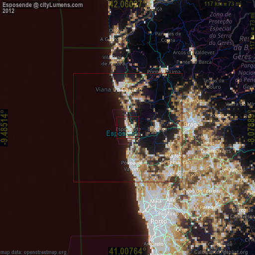
» Earth at Night: Flat Maps 2012, 2016