Marinhas night lights from space
Night Light of Marinhas (Braga) from space (Portugal) Src. Average luminocity for 10x10km area is 35.6173% and for 50x50km: 28.4745%.
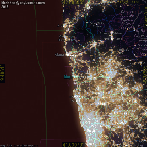
Analysis of Marinhas night lights 2016
Square area 10x10 km:
 1.53%
1.53%90-99
4.59%80-89
6.46%70-79
6.8%60-69
8.5%50-59
4.42%40-49
3.06%30-39
4.25%20-29
19.22%10-19
21.43%0-9
19.73%Square area 50x50 km:
2.43%90-99
4.94%80-89
3.91%70-79
3.65%60-69
6.02%50-59
6.4%40-49
5.56%30-39
4.89%20-29
7.78%10-19
11.01%0-9
43.42%Clear (daylight) street map image can be seen on geolist.org.
Map coordinates:
42° 4' 59" North, 9° 29' 10" West
41° 33' 32.6" North, 8° 46' 58.7" West
41° 1' 50.8" North, 8° 4' 47.5" West
Some cities around Marinhas sort by population:
• Viana do Castelo
15.5 km =9.6 mi,  344°
344°
• Esposende
2.6 km =1.6 mi,  178°
178°
• Barcelos
14 km =8.7 mi,  102°
102°
• Pedroso
16.7 km =10.4 mi,  170°
170°
• Aver-o-Mar
17 km =10.6 mi, 179°
• Meadela
16.4 km =10.2 mi,  356°
356°
• Darque
13.9 km =8.6 mi,  5°
5°
• Apúlia e Fão
5.3 km =3.3 mi, 170°
2737904 (p: 6,052)
Sources (retrieved 2019-11-25):
» Earth at Night: Flat Maps 2012, 2016