Vialonga night lights from space
Night Light of Vialonga (Lisbon) from space (Portugal) Src. Average luminocity for 10x10km area is 68.1905% and for 50x50km: 45.9196%.
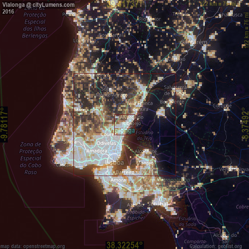
Analysis of Vialonga night lights 2016
Square area 10x10 km:
 21.94%
90-99
18.2%80-89
4.59%70-79
7.99%60-69
6.29%50-59
9.18%40-49
8.84%30-39
7.99%20-29
9.52%10-19
5.1%0-9
0.34%Square area 50x50 km:
12.68%90-99
9.41%80-89
4.17%70-79
3.91%60-69
5.79%50-59
5.83%40-49
5.86%30-39
8.3%20-29
11.89%10-19
13.37%0-9
18.81%Clear (daylight) street map image can be seen on geolist.org.
Map coordinates:
39° 25' 2.5" North, 9° 46' 52.2" West
38° 52' 19.4" North, 9° 4' 41" West
38° 19' 21.1" North, 8° 22' 29.7" West
Some cities around Vialonga sort by population:
• Póvoa de Santa Iria
1.7 km =1.1 mi,  136°
136°
• Camarate
8.8 km =5.5 mi,  209°
209°
• São João da Talha
5.6 km =3.5 mi,  197°
197°
• Santa Iria da Azóia
3.9 km =2.4 mi, 207°
• Unhos
6.9 km =4.3 mi, 211°
• Bobadela
7.4 km =4.6 mi,  194°
194°
• Alhandra
8.6 km =5.3 mi,  44°
44°
• Apelação
8 km =5 mi,  215°
215°
2261697 (p: 16,088)
Sources (retrieved 2019-11-25):
» Earth at Night: Flat Maps 2012, 2016