São João da Talha night lights from space
Night Light of São João da Talha (Lisbon) from space (Portugal) Src. Average luminocity for 10x10km area is 74.4218% and for 50x50km: 50.1867%.
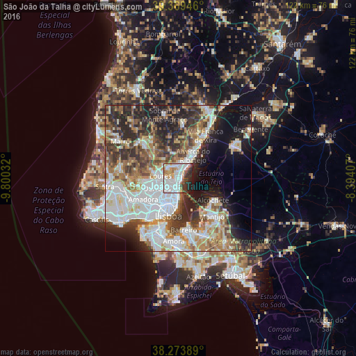
Analysis of São João da Talha night lights 2016
Square area 10x10 km:
 33.84%
90-99
19.73%80-89
2.72%70-79
8.33%60-69
5.78%50-59
3.4%40-49
2.38%30-39
8.33%20-29
10.71%10-19
4.76%0-9
0%Square area 50x50 km:
14.42%90-99
11.34%80-89
4.54%70-79
4.57%60-69
6.7%50-59
6.27%40-49
5.63%30-39
7.77%20-29
10.81%10-19
10.56%0-9
17.39%Clear (daylight) street map image can be seen on geolist.org.
Map coordinates:
39° 22' 10.1" North, 9° 48' 1.2" West
38° 49' 25.6" North, 9° 5' 49.9" West
38° 16' 26" North, 8° 23' 38.7" West
Some cities around São João da Talha sort by population:
• Póvoa de Santa Iria
5 km =3.1 mi,  34°
34°
• Camarate
3.5 km =2.2 mi,  230°
230°
• Santa Iria da Azóia
1.9 km =1.2 mi,  355°
355°
• Sacavém
3.7 km =2.3 mi,  194°
194°
• Unhos
2 km =1.2 mi,  256°
256°
• Bobadela
1.8 km =1.1 mi, 185°
• Apelação
3.2 km =2 mi,  250°
250°
• Prior Velho
4.1 km =2.5 mi,  210°
210°
2263326 (p: 18,925)
Sources (retrieved 2019-11-25):
» Earth at Night: Flat Maps 2012, 2016