Póvoa de Santa Iria night lights from space
Night Light of Póvoa de Santa Iria (Lisbon) from space (Portugal) Src. Average luminocity for 10x10km area is 60.9677% and for 50x50km: 45.2766%.
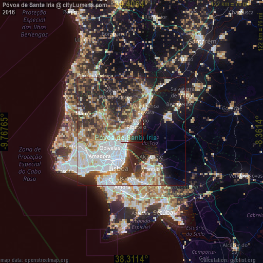
Analysis of Póvoa de Santa Iria night lights 2016
Square area 10x10 km:
 21.09%
90-99
17.01%80-89
2.89%70-79
4.08%60-69
5.78%50-59
6.8%40-49
6.46%30-39
7.99%20-29
13.1%10-19
10.2%0-9
4.59%Square area 50x50 km:
12.69%90-99
9.26%80-89
3.99%70-79
4.06%60-69
5.69%50-59
5.68%40-49
5.5%30-39
7.89%20-29
11.73%10-19
13.18%0-9
20.33%Clear (daylight) street map image can be seen on geolist.org.
Map coordinates:
39° 24' 23" North, 9° 46' 3.5" West
38° 51' 39.6" North, 9° 3' 52.3" West
38° 18' 41" North, 8° 21' 41" West
Some cities around Póvoa de Santa Iria sort by population:
• Camarate
8.4 km =5.2 mi,  220°
220°
• São João da Talha
5 km =3.1 mi,  214°
214°
• Santa Iria da Azóia
3.7 km =2.3 mi,  233°
233°
• Sacavém
8.5 km =5.3 mi, 206°
• Vialonga
1.7 km =1.1 mi,  316°
316°
• Unhos
6.7 km =4.2 mi, 226°
• Bobadela
6.6 km =4.1 mi, 206°
• Apelação
7.9 km =4.9 mi, 228°
2264359 (p: 28,901)
Sources (retrieved 2019-11-25):
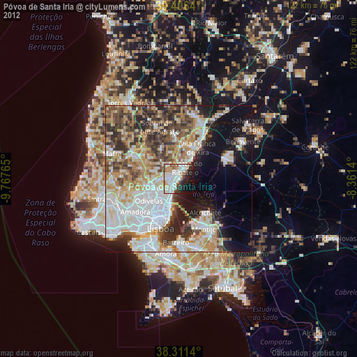
» Earth at Night: Flat Maps 2012, 2016