Sines night lights from space
Night Light of Sines (District of Setúbal) from space (Portugal) Src. Average luminocity for 10x10km area is 29.4091% and for 50x50km: 3.5413%.
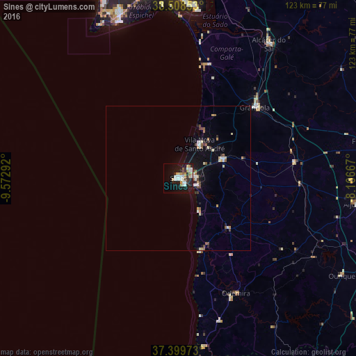
Analysis of Sines night lights 2016
Square area 10x10 km:
 6.49%
6.49%90-99
6.01%80-89
2.44%70-79
5.19%60-69
2.11%50-59
1.14%40-49
1.14%30-39
3.08%20-29
7.79%10-19
29.55%0-9
35.06%Square area 50x50 km:
0.5%90-99
0.55%80-89
0.39%70-79
0.49%60-69
0.25%50-59
0.36%40-49
0.36%30-39
0.25%20-29
0.85%10-19
2.72%0-9
93.28%Clear (daylight) street map image can be seen on geolist.org.
Map coordinates:
38° 30' 30.7" North, 9° 34' 22.5" West
37° 57' 22.4" North, 8° 52' 11.2" West
37° 23' 59" North, 8° 10' 0" West
Some cities around Sines sort by population:
• Setúbal
63.2 km =39.3 mi,  358°
358°
• Sesimbra
57.9 km =36 mi,  339°
339°
• Grândola
36.2 km =22.5 mi,  47°
47°
• Santo André
13.9 km =8.6 mi,  33°
33°
• Alcácer do Sal
55.8 km =34.7 mi, 33°
• Santiago do Cacém
16.8 km =10.4 mi,  66°
66°
• Odemira
44.7 km =27.8 mi,  153°
153°
• Aljustrel
62.4 km =38.8 mi,  98°
98°
2262917 (p: 12,791)
Sources (retrieved 2019-11-25):
» Earth at Night: Flat Maps 2012, 2016