Pontinha night lights from space
Night Light of Pontinha (Lisbon) from space (Portugal) Src. Average luminocity for 10x10km area is 98.665% and for 50x50km: 53.8184%.
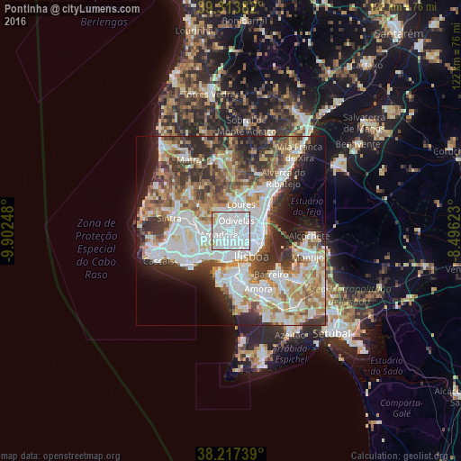
Analysis of Pontinha night lights 2016
Square area 10x10 km:
 82.14%
90-99
13.1%80-89
2.72%70-79
1.53%60-69
0.51%50-59
0%40-49
0%30-39
0%20-29
0%10-19
0%0-9
0%Square area 50x50 km:
15.66%90-99
13.02%80-89
5.26%70-79
5.44%60-69
7.5%50-59
6.2%40-49
6%30-39
7.34%20-29
9.28%10-19
7.45%0-9
16.84%Clear (daylight) street map image can be seen on geolist.org.
Map coordinates:
39° 18' 49.8" North, 9° 54' 8.9" West
38° 46' 3.8" North, 9° 11' 57.7" West
38° 13' 2.6" North, 8° 29' 46.4" West
Some cities around Pontinha sort by population:
• Amadora
3.1 km =1.9 mi,  240°
240°
• Odivelas
3.1 km =1.9 mi,  25°
25°
• Benfica
1.9 km =1.2 mi,  189°
189°
• Ramada
4.1 km =2.5 mi,  14°
14°
• Alfragide
4.3 km =2.7 mi,  203°
203°
• Póvoa de Santo Adrião
4.6 km =2.9 mi,  38°
38°
• Famões
2.5 km =1.6 mi,  337°
337°
• Olival do Basto
3.9 km =2.4 mi,  48°
48°
2264526 (p: 23,249)
Sources (retrieved 2019-11-25):
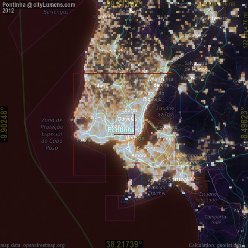
» Earth at Night: Flat Maps 2012, 2016