Amadora night lights from space
Night Light of Amadora (Lisbon) from space (Portugal) Src. Average luminocity for 10x10km area is 96.8503% and for 50x50km: 51.5954%.
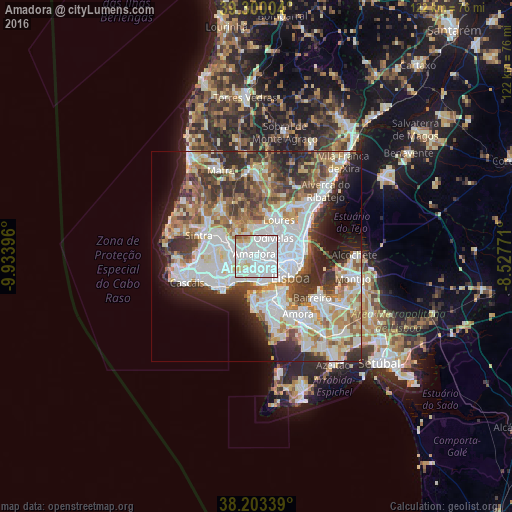

Analysis of Amadora night lights 2016
Square area 10x10 km:
 72.11%
90-99
16.5%80-89
5.61%70-79
2.89%60-69
1.7%50-59
1.19%40-49
0%30-39
0%20-29
0%10-19
0%0-9
0%Square area 50x50 km:
15.53%90-99
12.52%80-89
4.86%70-79
5.13%60-69
6.8%50-59
5.73%40-49
5.65%30-39
7.03%20-29
8.82%10-19
7.73%0-9
20.2%Clear (daylight) street map image can be seen on geolist.org.
Map coordinates:
39° 18' 0.1" North, 9° 56' 2.3" West
38° 45' 13.8" North, 9° 13' 51" West
38° 12' 12.2" North, 8° 31' 39.8" West
Some cities around Amadora sort by population:
• Queluz
2.1 km =1.3 mi,  278°
278°
• Benfica
2.5 km =1.6 mi,  97°
97°
• Massamá
4.4 km =2.7 mi,  268°
268°
• Carnaxide
3.3 km =2.1 mi,  204°
204°
• Pontinha
3.1 km =1.9 mi,  60°
60°
• Belas
3.8 km =2.4 mi,  311°
311°
• Alfragide
2.6 km =1.6 mi,  157°
157°
• Famões
4.2 km =2.6 mi,  25°
25°
2271772 (p: 178,858)
Sources (retrieved 2019-11-25):
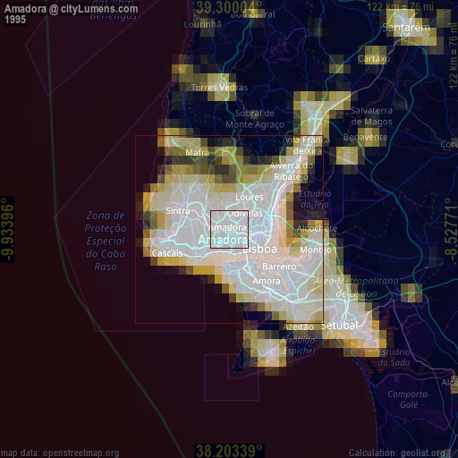
» NASA, Earths city lights 1995
» NASA city lights 2003
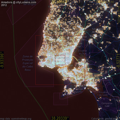
» Earth at Night: Flat Maps 2012, 2016