Foz do Sousa night lights from space
Night Light of Foz do Sousa (Porto) from space (Portugal) Src. Average luminocity for 10x10km area is 72.3474% and for 50x50km: 52.1609%.
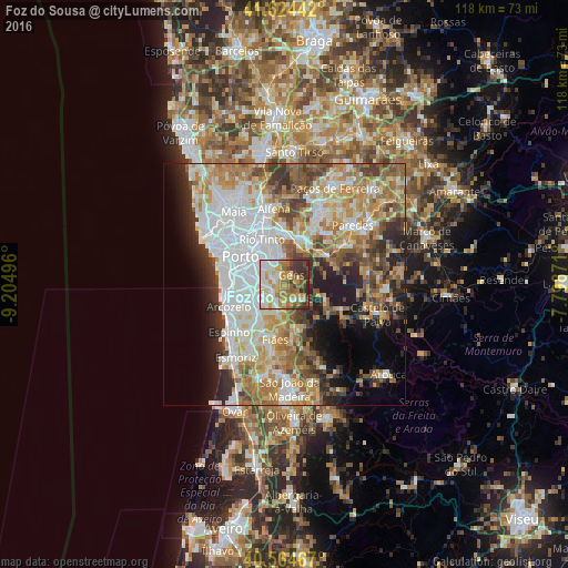
Analysis of Foz do Sousa night lights 2016
Square area 10x10 km:
 16.88%
90-99
16.4%80-89
9.58%70-79
14.94%60-69
12.99%50-59
8.44%40-49
5.84%30-39
10.55%20-29
4.38%10-19
0%0-9
0%Square area 50x50 km:
14.02%90-99
10.7%80-89
5.93%70-79
8.28%60-69
8.71%50-59
6.12%40-49
5.47%30-39
5.41%20-29
7.25%10-19
7.76%0-9
20.36%Clear (daylight) street map image can be seen on geolist.org.
Map coordinates:
41° 37' 27.9" North, 9° 12' 17.9" West
41° 5' 48" North, 8° 30' 6.6" West
40° 33' 52.8" North, 7° 47' 55.4" West
Some cities around Foz do Sousa sort by population:
• Gondomar
5.9 km =3.7 mi,  334°
334°
• Vilar de Andorinho
7.1 km =4.4 mi,  278°
278°
• São Pedro da Cova
5.2 km =3.2 mi,  1°
1°
• Valbom
6.2 km =3.9 mi,  305°
305°
• Avintes
4.3 km =2.7 mi,  285°
285°
• Jovim
2.1 km =1.3 mi,  317°
317°
• Sandim
6.9 km =4.3 mi,  183°
183°
• Olival
6.3 km =3.9 mi,  214°
214°
2739333 (p: 6,315)
Sources (retrieved 2019-11-25):
» Earth at Night: Flat Maps 2012, 2016