Argoncilhe night lights from space
Night Light of Argoncilhe (Aveiro) from space (Portugal) Src. Average luminocity for 10x10km area is 86.0527% and for 50x50km: 45.1423%.
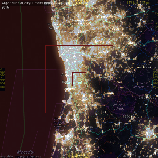
Analysis of Argoncilhe night lights 2016
Square area 10x10 km:
 20.58%
90-99
27.21%80-89
21.09%70-79
17.86%60-69
9.18%50-59
4.08%40-49
0%30-39
0%20-29
0%10-19
0%0-9
0%Square area 50x50 km:
12.84%90-99
8.96%80-89
5.06%70-79
6.12%60-69
7.38%50-59
5.29%40-49
4.63%30-39
5.06%20-29
6.86%10-19
8.14%0-9
29.66%Clear (daylight) street map image can be seen on geolist.org.
Map coordinates:
41° 33' 13.4" North, 9° 14' 31.1" West
41° 1' 31.5" North, 8° 32' 19.9" West
40° 29' 34.2" North, 7° 50' 8.6" West
Some cities around Argoncilhe sort by population:
• Grijó
3.5 km =2.2 mi,  275°
275°
• Lourosa
4.7 km =2.9 mi,  192°
192°
• Fiães
3.6 km =2.2 mi,  161°
161°
• Sandim
2.9 km =1.8 mi,  68°
68°
• Perozinho
5.9 km =3.7 mi,  318°
318°
• Olival
2.8 km =1.7 mi,  350°
350°
• Lamas
5.1 km =3.2 mi,  210°
210°
• Nogueira da Regedoura
5 km =3.1 mi,  243°
243°
2742750 (p: 8,743)
Sources (retrieved 2019-11-25):
» Earth at Night: Flat Maps 2012, 2016