Perozinho night lights from space
Night Light of Perozinho (Porto) from space (Portugal) Src. Average luminocity for 10x10km area is 96.224% and for 50x50km: 45.5068%.
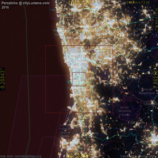
Analysis of Perozinho night lights 2016
Square area 10x10 km:
 51.79%
90-99
31.66%80-89
11.2%70-79
5.36%60-69
0%50-59
0%40-49
0%30-39
0%20-29
0%10-19
0%0-9
0%Square area 50x50 km:
13.79%90-99
9.91%80-89
5.05%70-79
6.78%60-69
7.05%50-59
4.44%40-49
3.81%30-39
4.1%20-29
5.68%10-19
7%0-9
32.4%Clear (daylight) street map image can be seen on geolist.org.
Map coordinates:
41° 35' 35.2" North, 9° 17' 18.3" West
41° 3' 54.5" North, 8° 35' 7.1" West
40° 31' 58.3" North, 7° 52' 55.8" West
Some cities around Perozinho sort by population:
• Vilar do Paraíso
4.1 km =2.5 mi,  312°
312°
• Arcozelo
3.9 km =2.4 mi,  264°
264°
• Canelas
2.4 km =1.5 mi,  328°
328°
• Azenha
3.5 km =2.2 mi,  290°
290°
• Grijó
4.1 km =2.5 mi,  173°
173°
• Gulpilhares
4 km =2.5 mi,  299°
299°
• Serzedo
3 km =1.9 mi,  238°
238°
• Olival
3.8 km =2.4 mi,  115°
115°
2736327 (p: 6,259)
Sources (retrieved 2019-11-25):
» Earth at Night: Flat Maps 2012, 2016