Qabāţīyah night lights from space
Night Light of Qabāţīyah (West Bank) from space (Palestinian Territory) Src. Average luminocity for 10x10km area is 44.6575% and for 50x50km: 42.9391%.
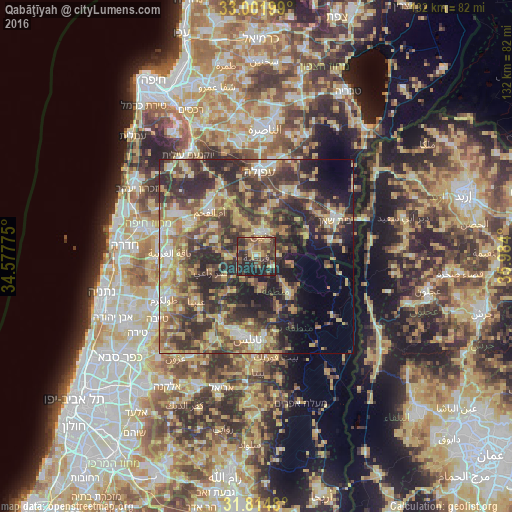
Analysis of Qabāţīyah night lights 2016
Square area 10x10 km:
 0.18%
0.18%90-99
0.92%80-89
7.33%70-79
10.99%60-69
4.21%50-59
11.9%40-49
18.5%30-39
12.64%20-29
27.47%10-19
5.86%0-9
0%Square area 50x50 km:
3.04%90-99
4.67%80-89
8.46%70-79
8.13%60-69
5.52%50-59
7.08%40-49
11.21%30-39
12.31%20-29
15.14%10-19
9.05%0-9
15.4%Clear (daylight) street map image can be seen on geolist.org.
Map coordinates:
33° 0' 7.2" North, 34° 34' 39.9" East
32° 24' 37.3" North, 35° 16' 51.1" East
31° 48' 53.3" North, 35° 59' 2.4" East
Some cities around Qabāţīyah sort by population:
• Janīn
5.8 km =3.6 mi,  18°
18°
• Al Yāmūn
9.6 km =6 mi,  330°
330°
• Ya‘bad
11.3 km =7 mi,  290°
290°
• ‘Arrābah
7.4 km =4.6 mi,  265°
265°
• Jaba‘
11.1 km =6.9 mi,  210°
210°
• Maythalūn
7 km =4.3 mi,  184°
184°
• Birqīn
5.3 km =3.3 mi,  339°
339°
• Dayr Abū Ḑa‘īf
9.1 km =5.7 mi,  56°
56°
282476 (p: 19,127)
Sources (retrieved 2019-11-25):
» Earth at Night: Flat Maps 2012, 2016