Janīn night lights from space
Night Light of Janīn (West Bank) from space (Palestinian Territory) Src. Average luminocity for 10x10km area is 59.8553% and for 50x50km: 42.2546%.
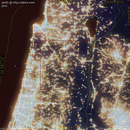
Analysis of Janīn night lights 2016
Square area 10x10 km:
 2.01%
2.01%90-99
5.13%80-89
16.3%70-79
15.2%60-69
7.88%50-59
11.72%40-49
23.81%30-39
12.27%20-29
5.68%10-19
0%0-9
0%Square area 50x50 km:
2.84%90-99
4.44%80-89
8.07%70-79
7.42%60-69
5.69%50-59
7.44%40-49
11.4%30-39
12.04%20-29
15.27%10-19
10.65%0-9
14.74%Clear (daylight) street map image can be seen on geolist.org.
Map coordinates:
33° 3' 2.7" North, 34° 35' 51.9" East
32° 27' 33.9" North, 35° 18' 3.1" East
31° 51' 51.2" North, 36° 0' 14.4" East
Some cities around Janīn sort by population:
• Qabāţīyah
5.8 km =3.6 mi,  198°
198°
• Al Yāmūn
7.2 km =4.5 mi,  293°
293°
• Ya‘bad
12.5 km =7.8 mi,  262°
262°
• ‘Arrābah
11.1 km =6.9 mi,  236°
236°
• Sīlat al Ḩārithīyah
8.8 km =5.5 mi,  308°
308°
• Maythalūn
12.6 km =7.8 mi,  191°
191°
• Birqīn
3.8 km =2.4 mi, 261°
• Dayr Abū Ḑa‘īf
5.7 km =3.5 mi,  93°
93°
283506 (p: 34,730)
Sources (retrieved 2019-11-25):
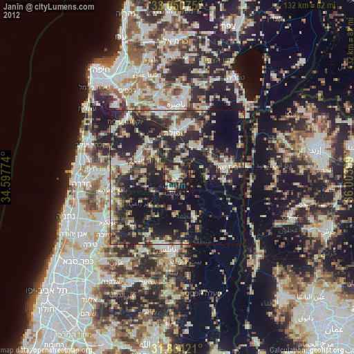
» Earth at Night: Flat Maps 2012, 2016