Dayr Abū Ḑa‘īf night lights from space
Night Light of Dayr Abū Ḑa‘īf (West Bank) from space (Palestinian Territory) Src. Average luminocity for 10x10km area is 40.652% and for 50x50km: 37.6866%.
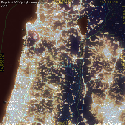
Analysis of Dayr Abū Ḑa‘īf night lights 2016
Square area 10x10 km:
 0.55%
0.55%90-99
1.28%80-89
5.86%70-79
4.95%60-69
7.69%50-59
3.66%40-49
22.89%30-39
16.67%20-29
19.41%10-19
15.75%0-9
1.28%Square area 50x50 km:
1.99%90-99
3.21%80-89
7.19%70-79
6.44%60-69
4.8%50-59
6.07%40-49
10.44%30-39
11.7%20-29
15.57%10-19
15.06%0-9
17.54%Clear (daylight) street map image can be seen on geolist.org.
Map coordinates:
33° 2' 50.5" North, 34° 39' 30.7" East
32° 27' 21.6" North, 35° 21' 41.9" East
31° 51' 38.7" North, 36° 3' 53.2" East
Some cities around Dayr Abū Ḑa‘īf sort by population:
• Janīn
5.7 km =3.5 mi,  273°
273°
• Qabāţīyah
9.1 km =5.7 mi,  236°
236°
• Bet She’an, IL
13.4 km =8.3 mi,  70°
70°
• Al Yāmūn
12.8 km =8 mi,  284°
284°
• Ţūbās
15 km =9.3 mi,  177°
177°
• Sīlat al Ḩārithīyah
13.9 km =8.6 mi,  294°
294°
• Maythalūn
14.5 km =9 mi,  214°
214°
• Birqīn
9.5 km =5.9 mi, 269°
284105 (p: 5,506)
Sources (retrieved 2019-11-25):
» Earth at Night: Flat Maps 2012, 2016