Jaba‘ night lights from space
Night Light of Jaba‘ (West Bank) from space (Palestinian Territory) Src. Average luminocity for 10x10km area is 35.9286% and for 50x50km: 50.134%.
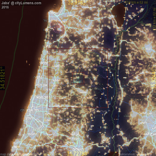
Analysis of Jaba‘ night lights 2016
Square area 10x10 km:
 0%
0%90-99
0%80-89
4.58%70-79
7.51%60-69
6.23%50-59
4.03%40-49
11.54%30-39
12.09%20-29
29.3%10-19
24.73%0-9
0%Square area 50x50 km:
4.78%90-99
6.96%80-89
10.78%70-79
9.88%60-69
7.56%50-59
8.68%40-49
10.78%30-39
10.29%20-29
11.46%10-19
7.35%0-9
11.5%Clear (daylight) street map image can be seen on geolist.org.
Map coordinates:
32° 54' 58.7" North, 34° 31' 5.6" East
32° 19' 26.7" North, 35° 13' 16.8" East
31° 43' 40.7" North, 35° 55' 28.1" East
Some cities around Jaba‘ sort by population:
• ‘Arrābah
9.2 km =5.7 mi,  348°
348°
• ‘Aşīrah ash Shamālīyah
9.2 km =5.7 mi,  151°
151°
• Kafr Rā‘ī
8.4 km =5.2 mi,  311°
311°
• ‘Anabtā
10 km =6.2 mi,  259°
259°
• Maythalūn
5.7 km =3.5 mi,  61°
61°
• Bal‘ā
10.4 km =6.5 mi,  276°
276°
• Sīlat az̧ Z̧ahr
3.5 km =2.2 mi, 261°
• Bayt Līd
11 km =6.8 mi,  230°
230°
283570 (p: 8,391)
Sources (retrieved 2019-11-25):
» Earth at Night: Flat Maps 2012, 2016