Ya‘bad night lights from space
Night Light of Ya‘bad (West Bank) from space (Palestinian Territory) Src. Average luminocity for 10x10km area is 50.2692% and for 50x50km: 54.5763%.
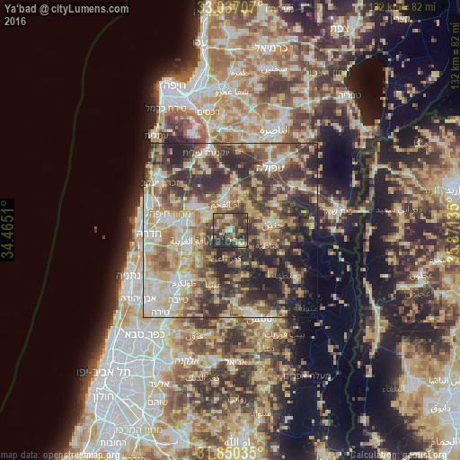
Analysis of Ya‘bad night lights 2016
Square area 10x10 km:
 1.28%
1.28%90-99
5.13%80-89
8.42%70-79
8.24%60-69
9.71%50-59
10.26%40-49
17.77%30-39
17.95%20-29
21.25%10-19
0%0-9
0%Square area 50x50 km:
6.15%90-99
8.69%80-89
11.56%70-79
9.24%60-69
7.29%50-59
8.21%40-49
11.58%30-39
12.46%20-29
15.36%10-19
6.4%0-9
3.07%Clear (daylight) street map image can be seen on geolist.org.
Map coordinates:
33° 2' 13.5" North, 34° 27' 54.4" East
32° 26' 44.4" North, 35° 10' 5.6" East
31° 51' 1.3" North, 35° 52' 16.9" East
Some cities around Ya‘bad sort by population:
• Umm el Faḥm, IL
8.1 km =5 mi,  350°
350°
• Al Yāmūn
7.3 km =4.5 mi,  52°
52°
• ‘Arrābah
5.5 km =3.4 mi,  144°
144°
• Sīlat al Ḩārithīyah
8.9 km =5.5 mi,  38°
38°
• Qaffīn
8.2 km =5.1 mi,  259°
259°
• Kafr Rā‘ī
8.1 km =5 mi,  189°
189°
• ‘Illār
10.2 km =6.3 mi,  214°
214°
• Birqīn
8.7 km =5.4 mi,  83°
83°
281318 (p: 13,477)
Sources (retrieved 2019-11-25):
» Earth at Night: Flat Maps 2012, 2016