East Jerusalem night lights from space
Night Light of East Jerusalem (West Bank) from space (Palestinian Territory) Src. Average luminocity for 10x10km area is 96.033% and for 50x50km: 47.6024%.
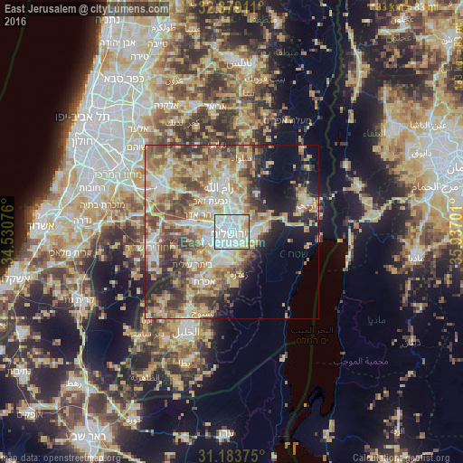
Analysis of East Jerusalem night lights 2016
Square area 10x10 km:
 56.96%
90-99
26.19%80-89
10.99%70-79
3.66%60-69
2.2%50-59
0%40-49
0%30-39
0%20-29
0%10-19
0%0-9
0%Square area 50x50 km:
8.17%90-99
8.1%80-89
9.35%70-79
9.62%60-69
5.24%50-59
7.93%40-49
7.97%30-39
6%20-29
6.46%10-19
8.07%0-9
23.09%Clear (daylight) street map image can be seen on geolist.org.
Map coordinates:
32° 22' 44.8" North, 34° 31' 50.7" East
31° 47' 0.1" North, 35° 14' 2" East
31° 11' 1.5" North, 35° 56' 13.2" East
Some cities around East Jerusalem sort by population:
• Jerusalem, IL
2.3 km =1.4 mi,  226°
226°
• West Jerusalem, IL
1.4 km =0.9 mi,  263°
263°
• Old City
0.7 km =0.4 mi,  177°
177°
• Ar Rām wa Ḑāḩiyat al Barīd
7.3 km =4.5 mi,  0°
0°
• Al ‘Ayzarīyah
3.6 km =2.2 mi,  112°
112°
• ‘Anātā
3.7 km =2.3 mi,  39°
39°
• Abū Dīs
3.5 km =2.2 mi,  131°
131°
• Ḩizmā
6.2 km =3.9 mi,  26°
26°
7303419 (p: 428,304)
Sources (retrieved 2019-11-25):
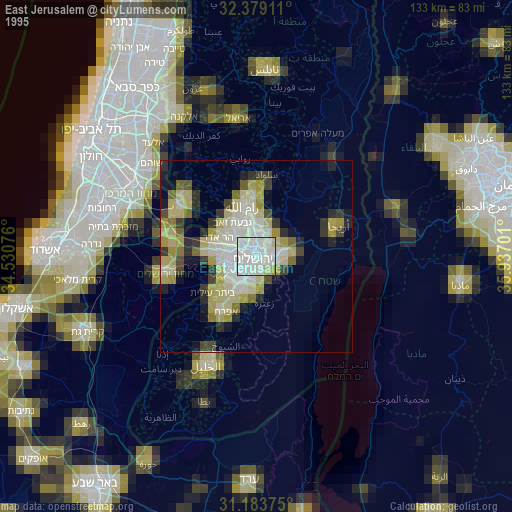
» NASA, Earths city lights 1995
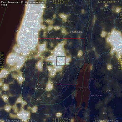
» NASA city lights 2003
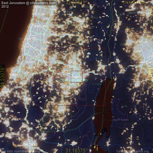
» Earth at Night: Flat Maps 2012, 2016