‘Anātā night lights from space
Night Light of ‘Anātā (West Bank) from space (Palestinian Territory) Src. Average luminocity for 10x10km area is 90.1612% and for 50x50km: 45.1327%.
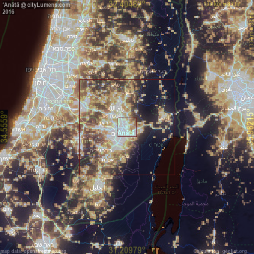
Analysis of ‘Anātā night lights 2016
Square area 10x10 km:
 44.69%
90-99
23.99%80-89
11.17%70-79
6.78%60-69
5.86%50-59
4.03%40-49
2.01%30-39
1.47%20-29
0%10-19
0%0-9
0%Square area 50x50 km:
7.56%90-99
7.38%80-89
8.59%70-79
8.71%60-69
4.92%50-59
7.14%40-49
8.6%30-39
6.64%20-29
6.9%10-19
8.5%0-9
25.05%Clear (daylight) street map image can be seen on geolist.org.
Map coordinates:
32° 24' 17.4" North, 34° 33' 21.2" East
31° 48' 33.3" North, 35° 15' 32.5" East
31° 12' 35.2" North, 35° 57' 43.7" East
Some cities around ‘Anātā sort by population:
• Jerusalem, IL
6 km =3.7 mi,  222°
222°
• East Jerusalem
3.7 km =2.3 mi, 219°
• West Jerusalem, IL
4.8 km =3 mi,  230°
230°
• Old City
4.3 km =2.7 mi,  212°
212°
• Ar Rām wa Ḑāḩiyat al Barīd
5 km =3.1 mi,  332°
332°
• Al ‘Ayzarīyah
4.4 km =2.7 mi,  167°
167°
• Abū Dīs
5.2 km =3.2 mi,  177°
177°
• Ḩizmā
2.7 km =1.7 mi,  8°
8°
284973 (p: 11,946)
Sources (retrieved 2019-11-25):
» Earth at Night: Flat Maps 2012, 2016