Bayt Ūmmar night lights from space
Night Light of Bayt Ūmmar (West Bank) from space (Palestinian Territory) Src. Average luminocity for 10x10km area is 59.9762% and for 50x50km: 43.5207%.
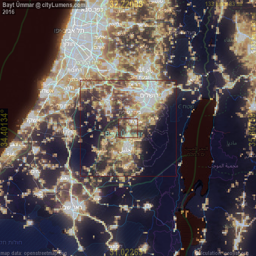
Analysis of Bayt Ūmmar night lights 2016
Square area 10x10 km:
 4.95%
4.95%90-99
8.06%80-89
12.09%70-79
15.02%60-69
2.56%50-59
16.12%40-49
17.03%30-39
19.41%20-29
4.76%10-19
0%0-9
0%Square area 50x50 km:
6.85%90-99
6.38%80-89
7.08%70-79
9.26%60-69
4.97%50-59
7.51%40-49
8.86%30-39
6.88%20-29
8.46%10-19
10.27%0-9
23.48%Clear (daylight) street map image can be seen on geolist.org.
Map coordinates:
32° 13' 12.3" North, 34° 24' 4.8" East
31° 37' 23.8" North, 35° 6' 16.1" East
31° 1' 21.5" North, 35° 48' 27.3" East
Some cities around Bayt Ūmmar sort by population:
• Ḩalḩūl
4.8 km =3 mi,  183°
183°
• Sa‘īr
6 km =3.7 mi,  145°
145°
• Şūrīf
4.9 km =3 mi,  308°
308°
• Efrata
5.4 km =3.4 mi,  52°
52°
• Al Khaḑir
9.8 km =6.1 mi,  36°
36°
• Ash Shuyūkh
7.7 km =4.8 mi,  140°
140°
• Khārās
6 km =3.7 mi,  260°
260°
• Naḩḩālīn
7.1 km =4.4 mi,  12°
12°
284329 (p: 12,238)
Sources (retrieved 2019-11-25):
» Earth at Night: Flat Maps 2012, 2016