Naḩḩālīn night lights from space
Night Light of Naḩḩālīn (West Bank) from space (Palestinian Territory) Src. Average luminocity for 10x10km area is 72.0037% and for 50x50km: 48.2694%.
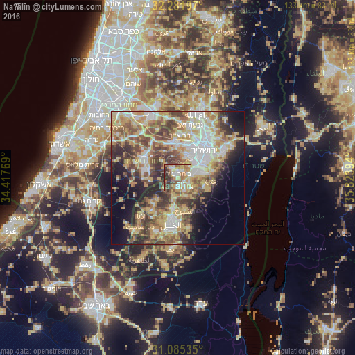
Analysis of Naḩḩālīn night lights 2016
Square area 10x10 km:
 12.64%
90-99
16.67%80-89
11.17%70-79
18.5%60-69
11.9%50-59
9.89%40-49
7.51%30-39
8.42%20-29
3.3%10-19
0%0-9
0%Square area 50x50 km:
8.4%90-99
8.21%80-89
8.72%70-79
9.81%60-69
5.51%50-59
7.91%40-49
8.33%30-39
6.82%20-29
6.64%10-19
8.86%0-9
20.79%Clear (daylight) street map image can be seen on geolist.org.
Map coordinates:
32° 16' 55.1" North, 34° 25' 3.7" East
31° 41' 8.1" North, 35° 7' 14.9" East
31° 5' 7.3" North, 35° 49' 26.2" East
Some cities around Naḩḩālīn sort by population:
• Bayt Jālā
7.2 km =4.5 mi,  62°
62°
• Şūrīf
6.6 km =4.1 mi,  234°
234°
• Bayt Ūmmar
7.1 km =4.4 mi,  192°
192°
• Bayt Fajjār
7.5 km =4.7 mi,  154°
154°
• Efrata
4.6 km =2.9 mi,  142°
142°
• Ad Dawḩah
5.9 km =3.7 mi,  74°
74°
• Al Khaḑir
4.5 km =2.8 mi,  77°
77°
• Ḩūsān
2.9 km =1.8 mi,  26°
26°
282593 (p: 6,215)
Sources (retrieved 2019-11-25):
» Earth at Night: Flat Maps 2012, 2016