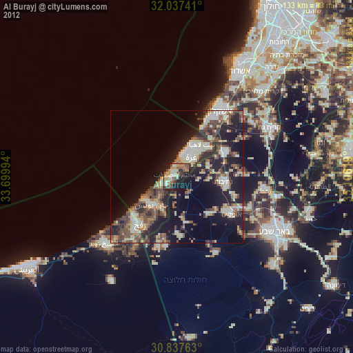
Al Burayj night lights from space
Night Light of Al Burayj (Gaza Strip) from space (Palestinian Territory) Src. Average luminocity for 10x10km area is 44.472% and for 50x50km: 25.6764%.
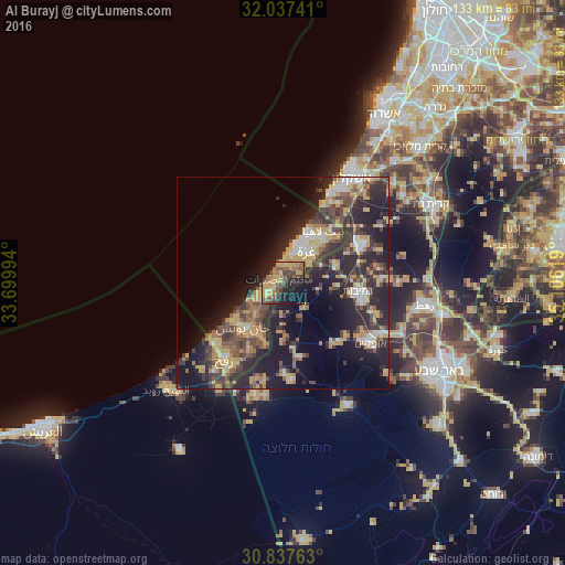
Analysis of Al Burayj night lights 2016
Square area 10x10 km:
 0.87%
0.87%90-99
1.57%80-89
9.97%70-79
12.24%60-69
6.47%50-59
10.84%40-49
12.94%30-39
5.07%20-29
15.91%10-19
22.38%0-9
1.75%Square area 50x50 km:
2.02%90-99
2.57%80-89
4.12%70-79
5.28%60-69
2.88%50-59
2.97%40-49
6.08%30-39
5.57%20-29
11.6%10-19
15.2%0-9
41.71%Clear (daylight) street map image can be seen on geolist.org.
Map coordinates:
32° 2' 14.7" North, 33° 41' 59.8" East
31° 26' 22" North, 34° 24' 11" East
30° 50' 15.5" North, 35° 6' 22.3" East
Some cities around Al Burayj sort by population:
• Gaza
9.2 km =5.7 mi,  41°
41°
• Jabālyā
12.4 km =7.7 mi, 38°
• Dayr al Balaḩ
5.5 km =3.4 mi,  244°
244°
• An Nuşayrāt
1.4 km =0.9 mi,  315°
315°
• Al Qarārah
9.4 km =5.8 mi,  219°
219°
• Az Zuwāydah
2.1 km =1.3 mi,  270°
270°
• Al Mughrāqah
3.1 km =1.9 mi,  16°
16°
• ‘Abasān al Jadīdah
12.2 km =7.6 mi,  206°
206°
281161 (p: 34,951)
Sources (retrieved 2019-11-25):
» Earth at Night: Flat Maps 2012, 2016