Santa Barbara night lights from space
Night Light of Santa Barbara (Canóvanas) from space (Puerto Rico) Src. Average luminocity for 10x10km area is 66.7211% and for 50x50km: 36.0014%.
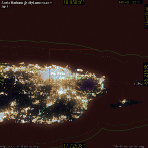
Analysis of Santa Barbara night lights 2016
Square area 10x10 km:
 15.29%
90-99
15.91%80-89
7.85%70-79
9.71%60-69
10.33%50-59
10.12%40-49
6.2%30-39
10.74%20-29
12.6%10-19
1.24%0-9
0%Square area 50x50 km:
8.88%90-99
5.21%80-89
3.93%70-79
5.03%60-69
6.57%50-59
5.81%40-49
5.72%30-39
4.94%20-29
6.39%10-19
9.36%0-9
38.17%Clear (daylight) street map image can be seen on geolist.org.
Map coordinates:
19° 3' 34.1" North, 66° 37' 18.9" West
18° 23' 36.8" North, 65° 55' 7.6" West
17° 43' 30.3" North, 65° 12' 56.4" West
Some cities around Santa Barbara sort by population:
• Carolina
4.3 km =2.7 mi,  250°
250°
• Trujillo Alto
10.3 km =6.4 mi, 245°
• Río Grande
9.4 km =5.8 mi,  99°
99°
• Gurabo
16.5 km =10.3 mi,  200°
200°
• Juncos
18.5 km =11.5 mi,  180°
180°
• Canovanas
2.9 km =1.8 mi,  135°
135°
• San Isidro
3.5 km =2.2 mi,  92°
92°
• Loíza
5.9 km =3.7 mi,  44°
44°
4568194 (p: 5,168)
Sources (retrieved 2019-11-25):
» Earth at Night: Flat Maps 2012, 2016