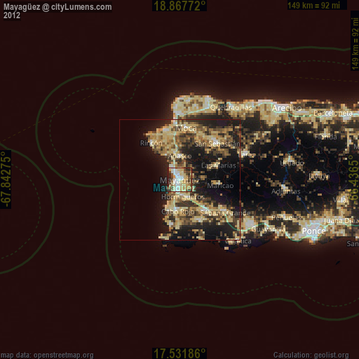
Mayagüez night lights from space
Night Light of Mayagüez from space (Puerto Rico) Src. Average luminocity for 10x10km area is 65.2922% and for 50x50km: 24.5796%.

Analysis of Mayagüez night lights 2016
Square area 10x10 km:
 11.9%
11.9%90-99
11.9%80-89
11.47%70-79
13.64%60-69
14.5%50-59
4.11%40-49
9.31%30-39
8.23%20-29
14.72%10-19
0.22%0-9
0%Square area 50x50 km:
1.07%90-99
1.75%80-89
4.79%70-79
3.79%60-69
5.41%50-59
3.23%40-49
4.42%30-39
7.17%20-29
9.61%10-19
15.58%0-9
43.19%Clear (daylight) street map image can be seen on geolist.org.
Map coordinates:
18° 52' 3.8" North, 67° 50' 33.9" West
18° 12' 3.9" North, 67° 8' 22.6" West
17° 31' 54.7" North, 66° 26' 11.4" West
Some cities around Mayagüez sort by population:
• San Germán
16.6 km =10.3 mi,  142°
142°
• Hormigueros
6.9 km =4.3 mi,  169°
169°
• Cabo Rojo
12.7 km =7.9 mi,  182°
182°
• Puerto Real
14.9 km =9.3 mi,  199°
199°
• Añasco
9.1 km =5.7 mi,  0°
0°
• Lajas
18.8 km =11.7 mi,  153°
153°
• Maricao
17 km =10.6 mi,  97°
97°
• Las Marías
16.6 km =10.3 mi,  70°
70°
4566385 (p: 78,647)
Sources (retrieved 2019-11-25):
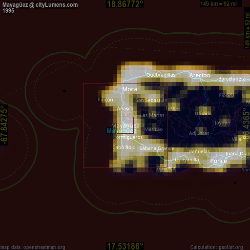
» NASA, Earths city lights 1995
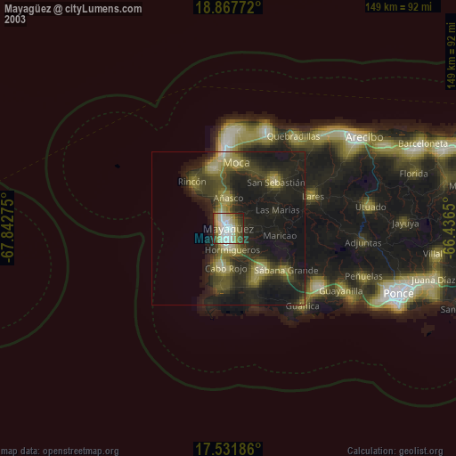
» NASA city lights 2003
» Earth at Night: Flat Maps 2012, 2016