Maricao night lights from space
Night Light of Maricao from space (Puerto Rico) Src. Average luminocity for 10x10km area is 7.4113% and for 50x50km: 28.2105%.
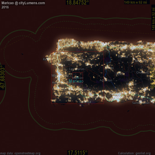
Analysis of Maricao night lights 2016
Square area 10x10 km:
 0.43%
0.43%90-99
0.43%80-89
0.43%70-79
0.65%60-69
1.52%50-59
0%40-49
0%30-39
3.25%20-29
1.3%10-19
6.06%0-9
85.93%Square area 50x50 km:
1.28%90-99
2.12%80-89
5.32%70-79
4.38%60-69
5.67%50-59
3.65%40-49
4.61%30-39
8.35%20-29
11.45%10-19
19.53%0-9
33.63%Clear (daylight) street map image can be seen on geolist.org.
Map coordinates:
18° 50' 51.1" North, 67° 40' 58.9" West
18° 10' 50.8" North, 66° 58' 47.6" West
17° 30' 41.4" North, 66° 16' 36.4" West
Some cities around Maricao sort by population:
• Mayagüez
17 km =10.6 mi,  277°
277°
• San Germán
13 km =8.1 mi,  211°
211°
• Hormigueros
16.2 km =10.1 mi,  253°
253°
• San Sebastián
17.4 km =10.8 mi,  356°
356°
• Sabana Grande
11.6 km =7.2 mi,  169°
169°
• Lares
16.7 km =10.4 mi,  40°
40°
• Lajas
16.8 km =10.4 mi, 209°
• Las Marías
8 km =5 mi,  350°
350°
4566178 (p: 1,172)
Sources (retrieved 2019-11-25):
» Earth at Night: Flat Maps 2012, 2016