Luquillo night lights from space
Night Light of Luquillo from space (Puerto Rico) Src. Average luminocity for 10x10km area is 37.2707% and for 50x50km: 17.5867%.
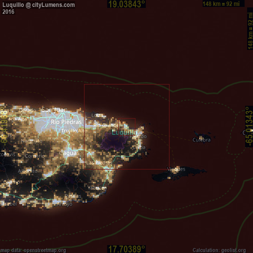
Analysis of Luquillo night lights 2016
Square area 10x10 km:
 1.03%
1.03%90-99
3.31%80-89
6.61%70-79
4.96%60-69
10.95%50-59
7.02%40-49
4.13%30-39
8.06%20-29
15.08%10-19
30.58%0-9
8.26%Square area 50x50 km:
1.42%90-99
1.87%80-89
2.19%70-79
2.3%60-69
3.96%50-59
3.4%40-49
3.77%30-39
4.08%20-29
5.37%10-19
10.11%0-9
61.53%Clear (daylight) street map image can be seen on geolist.org.
Map coordinates:
19° 2' 18.3" North, 66° 25' 10.8" West
18° 22' 20.8" North, 65° 42' 59.6" West
17° 42' 14" North, 65° 0' 48.3" West
Some cities around Luquillo sort by population:
• Fajardo
8.5 km =5.3 mi,  127°
127°
• Río Grande
12.1 km =7.5 mi,  274°
274°
• Canovanas
19.3 km =12 mi, 270°
• San Isidro
18 km =11.2 mi,  277°
277°
• Ceiba
14 km =8.7 mi,  149°
149°
• Santa Barbara
21.5 km =13.4 mi, 276°
• Naguabo
18 km =11.2 mi,  186°
186°
• Loíza
18.5 km =11.5 mi,  290°
290°
4566103 (p: 8,326)
Sources (retrieved 2019-11-25):
» Earth at Night: Flat Maps 2012, 2016