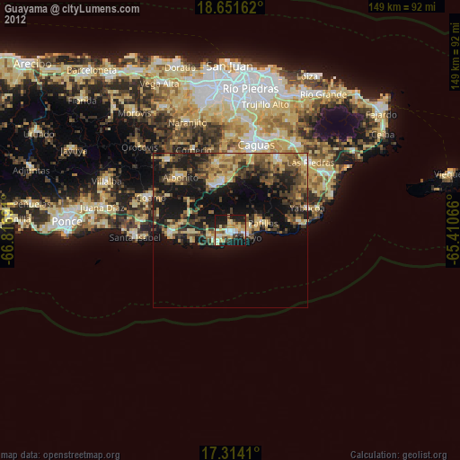
Guayama night lights from space
Night Light of Guayama from space (Puerto Rico) Src. Average luminocity for 10x10km area is 46.0584% and for 50x50km: 17.0428%.
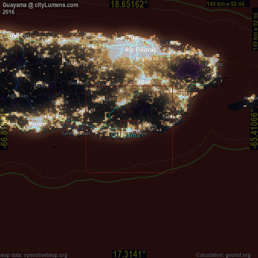
Analysis of Guayama night lights 2016
Square area 10x10 km:
100  6.28%
6.28%
90-99 5.63%
80-89 11.04%
70-79 8.87%
60-69 4.55%
50-59 2.6%
40-49 6.28%
30-39 8.87%
20-29 16.67%
10-19 29%
0-9 0.22%
6.28%90-99
5.63%80-89
11.04%70-79
8.87%60-69
4.55%50-59
2.6%40-49
6.28%30-39
8.87%20-29
16.67%10-19
29%0-9
0.22%Square area 50x50 km:
100 0.81%
90-99 1.16%
80-89 2.24%
70-79 1.62%
60-69 3.1%
50-59 3.25%
40-49 4.06%
30-39 4.8%
20-29 5.56%
10-19 17.58%
0-9 55.82%
0.81%90-99
1.16%80-89
2.24%70-79
1.62%60-69
3.1%50-59
3.25%40-49
4.06%30-39
4.8%20-29
5.56%10-19
17.58%0-9
55.82%Clear (daylight) street map image can be seen on geolist.org.
Map coordinates:
18° 39' 5.8" North, 66° 49' 0.9" West
17° 59' 2.9" North, 66° 6' 49.6" West
17° 18' 50.8" North, 65° 24' 38.4" West
Some cities around Guayama sort by population:
• Cayey
15.2 km =9.4 mi,  338°
338°
• Aibonito
23.6 km =14.7 mi,  317°
317°
• Arroyo
5.9 km =3.7 mi,  110°
110°
• Salinas
19.5 km =12.1 mi,  267°
267°
• Coco
15.6 km =9.7 mi,  279°
279°
• Cidra
21.9 km =13.6 mi,  346°
346°
• Patillas
10.7 km =6.6 mi,  76°
76°
• Maunabo
22.8 km =14.2 mi, 83°
4565105 (p: 21,575)
Sources (retrieved 2019-11-25):
» Earth at Night: Flat Maps 2012, 2016