Orocovis night lights from space
Night Light of Orocovis from space (Puerto Rico) Src. Average luminocity for 10x10km area is 10.9524% and for 50x50km: 33.1175%.
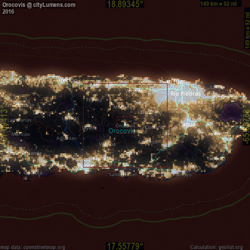
Analysis of Orocovis night lights 2016
Square area 10x10 km:
 0.43%
0.43%90-99
1.08%80-89
0.22%70-79
0.65%60-69
1.73%50-59
0.87%40-49
1.95%30-39
5.19%20-29
2.81%10-19
7.79%0-9
77.27%Square area 50x50 km:
4.06%90-99
3.89%80-89
4.97%70-79
4.59%60-69
6.4%50-59
4.08%40-49
5.69%30-39
7.87%20-29
10.57%10-19
18.47%0-9
29.42%Clear (daylight) street map image can be seen on geolist.org.
Map coordinates:
18° 53' 36.4" North, 67° 5' 38.9" West
18° 13' 36.8" North, 66° 23' 27.6" West
17° 33' 28" North, 65° 41' 16.4" West
Some cities around Orocovis sort by population:
• Coamo
16.7 km =10.4 mi,  167°
167°
• Corozal
14.9 km =9.3 mi,  31°
31°
• Aibonito
16.4 km =10.2 mi,  126°
126°
• Villalba
15.4 km =9.6 mi,  223°
223°
• Ciales
14.7 km =9.1 mi,  325°
325°
• Barranquitas
10 km =6.2 mi,  116°
116°
• Morovis
11.1 km =6.9 mi,  351°
351°
• Naranjito
17.5 km =10.9 mi,  61°
61°
4566454 (p: 944)
Sources (retrieved 2019-11-25):
» Earth at Night: Flat Maps 2012, 2016