Zwoleń night lights from space
Night Light of Zwoleń (Mazovia) from space (Poland) Src. Average luminocity for 10x10km area is 2.6345% and for 50x50km: 2.1402%.
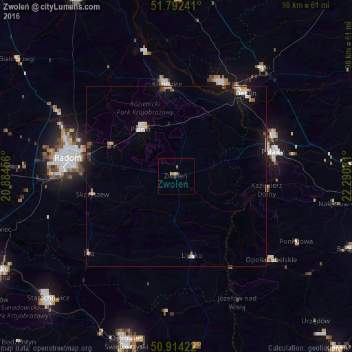
Analysis of Zwoleń night lights 2016
Square area 10x10 km:
 0%
0%90-99
0%80-89
1.12%70-79
0.28%60-69
1.4%50-59
0%40-49
0%30-39
0%20-29
0.56%10-19
0.56%0-9
96.08%Square area 50x50 km:
0.22%90-99
0.42%80-89
0.17%70-79
0.22%60-69
0.26%50-59
0.2%40-49
0.26%30-39
0.15%20-29
0.14%10-19
1.89%0-9
96.08%Clear (daylight) street map image can be seen on geolist.org.
Map coordinates:
51° 47' 32.7" North, 20° 53' 4.4" East
51° 21' 19.5" North, 21° 35' 15.6" East
50° 54' 51.2" North, 22° 17' 26.9" East
Some cities around Zwoleń sort by population:
• Radom
31 km =19.3 mi,  279°
279°
• Puławy
27.3 km =17 mi,  75°
75°
• Pionki
16.5 km =10.3 mi,  324°
324°
• Kozienice
25.4 km =15.8 mi,  353°
353°
• Dęblin
29 km =18 mi,  38°
38°
• Opole Lubelskie
35.2 km =21.9 mi,  131°
131°
• Lipsko
22.2 km =13.8 mi,  168°
168°
• Iłża
32.3 km =20.1 mi,  228°
228°
753004 (p: 8,048)
Sources (retrieved 2019-11-25):
» Earth at Night: Flat Maps 2012, 2016