Lipsko night lights from space
Night Light of Lipsko (Mazovia) from space (Poland) Src. Average luminocity for 10x10km area is 1.865% and for 50x50km: 1.6872%.
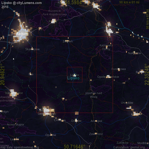
Analysis of Lipsko night lights 2016
Square area 10x10 km:
 0.4%
0.4%90-99
0.67%80-89
0%70-79
0.4%60-69
0.13%50-59
0.4%40-49
0.13%30-39
0%20-29
0%10-19
0%0-9
97.86%Square area 50x50 km:
0.25%90-99
0.29%80-89
0.13%70-79
0.29%60-69
0.24%50-59
0.11%40-49
0.33%30-39
0.17%20-29
0.12%10-19
1.17%0-9
96.91%Clear (daylight) street map image can be seen on geolist.org.
Map coordinates:
51° 35' 54.2" North, 20° 56' 46.4" East
51° 9' 34.3" North, 21° 38' 57.6" East
50° 42' 59.3" North, 22° 21' 8.9" East
Some cities around Lipsko sort by population:
• Ostrowiec Świętokrzyski
31.6 km =19.6 mi,  215°
215°
• Starachowice
42.6 km =26.5 mi,  251°
251°
• Puławy
36.2 km =22.5 mi,  37°
37°
• Pionki
37.8 km =23.5 mi,  338°
338°
• Poniatowa
33.7 km =20.9 mi,  86°
86°
• Opole Lubelskie
22.3 km =13.9 mi, 93°
• Zwoleń
22.2 km =13.8 mi,  348°
348°
• Iłża
28.6 km =17.8 mi,  270°
270°
766137 (p: 5,723)
Sources (retrieved 2019-11-25):
» Earth at Night: Flat Maps 2012, 2016