Wola night lights from space
Night Light of Wola (Silesia) from space (Poland) Src. Average luminocity for 10x10km area is 14.7409% and for 50x50km: 24.3371%.
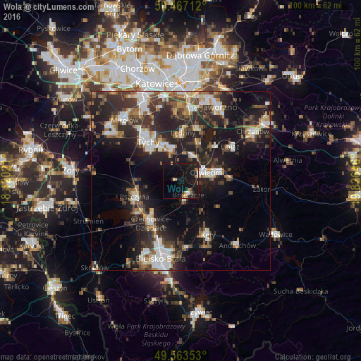
Analysis of Wola night lights 2016
Square area 10x10 km:
 0.56%
0.56%90-99
1.12%80-89
1.4%70-79
1.68%60-69
3.92%50-59
0.98%40-49
0.14%30-39
1.26%20-29
2.94%10-19
29.97%0-9
56.02%Square area 50x50 km:
4.01%90-99
4.34%80-89
1.55%70-79
2.21%60-69
3.07%50-59
3.35%40-49
4.1%30-39
5.15%20-29
9.34%10-19
16.89%0-9
45.99%Clear (daylight) street map image can be seen on geolist.org.
Map coordinates:
50° 28' 1.6" North, 18° 25' 12.8" East
50° 1' 2.8" North, 19° 7' 24" East
49° 33' 48.7" North, 19° 49' 35.3" East
Some cities around Wola sort by population:
• Oświęcim
6.5 km =4 mi,  73°
73°
• Pszczyna
12.8 km =8 mi,  251°
251°
• Bieruń
8.4 km =5.2 mi,  344°
344°
• Brzeszcze
4.4 km =2.7 mi,  152°
152°
• Chełmek
12.9 km =8 mi,  43°
43°
• Osiek
12.5 km =7.8 mi,  126°
126°
• Goczałkowice Zdrój
13.7 km =8.5 mi,  233°
233°
• Chełm Śląski
11.3 km =7 mi,  27°
27°
3081604 (p: 8,508)
Sources (retrieved 2019-11-25):
» Earth at Night: Flat Maps 2012, 2016