Twardogóra night lights from space
Night Light of Twardogóra (Lower Silesia) from space (Poland) Src. Average luminocity for 10x10km area is 1.6821% and for 50x50km: 2.8584%.
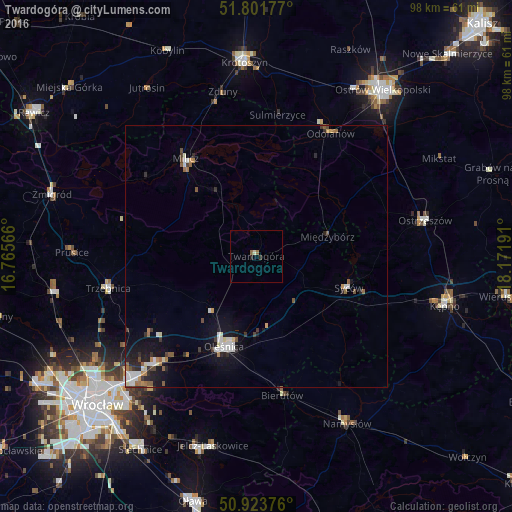
Analysis of Twardogóra night lights 2016
Square area 10x10 km:
 0%
0%90-99
0.56%80-89
0%70-79
0%60-69
0.7%50-59
0.42%40-49
0%30-39
0%20-29
0.98%10-19
0.14%0-9
97.2%Square area 50x50 km:
0.44%90-99
0.52%80-89
0.17%70-79
0.25%60-69
0.43%50-59
0.39%40-49
0.25%30-39
0.38%20-29
0.67%10-19
1.97%0-9
94.52%Clear (daylight) street map image can be seen on geolist.org.
Map coordinates:
51° 48' 6.4" North, 16° 45' 56.4" East
51° 21' 53.5" North, 17° 28' 7.6" East
50° 55' 25.5" North, 18° 10' 18.9" East
Some cities around Twardogóra sort by population:
• Oleśnica
17.7 km =11 mi,  198°
198°
• Ostrzeszów
33 km =20.5 mi,  78°
78°
• Trzebnica
28.8 km =17.9 mi,  257°
257°
• Milicz
22.7 km =14.1 mi,  322°
322°
• Syców
18.5 km =11.5 mi,  109°
109°
• Zakrzów
32 km =19.9 mi,  226°
226°
• Psie Pole Południe-Kiełczów
33.9 km =21.1 mi,  224°
224°
• Bierutów
27.3 km =17 mi,  168°
168°
3082938 (p: 6,840)
Sources (retrieved 2019-11-25):
» Earth at Night: Flat Maps 2012, 2016