Bierutów night lights from space
Night Light of Bierutów (Lower Silesia) from space (Poland) Src. Average luminocity for 10x10km area is 1.504% and for 50x50km: 3.0316%.
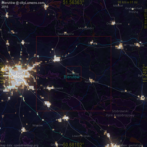
Analysis of Bierutów night lights 2016
Square area 10x10 km:
 0%
0%90-99
0.4%80-89
0.13%70-79
0%60-69
0.27%50-59
0.27%40-49
0.53%30-39
0%20-29
1.07%10-19
0%0-9
97.33%Square area 50x50 km:
0.51%90-99
0.61%80-89
0.17%70-79
0.16%60-69
0.29%50-59
0.38%40-49
0.26%30-39
0.34%20-29
0.34%10-19
2.3%0-9
94.64%Clear (daylight) street map image can be seen on geolist.org.
Map coordinates:
51° 33' 49.1" North, 16° 50' 34.6" East
51° 7' 27.9" North, 17° 32' 45.9" East
50° 40' 51.7" North, 18° 14' 57.1" East
Some cities around Bierutów sort by population:
• Oleśnica
14.7 km =9.1 mi,  312°
312°
• Oława
26.6 km =16.5 mi,  221°
221°
• Namysłów
13.5 km =8.4 mi,  113°
113°
• Jelcz Laskowice
19.7 km =12.2 mi,  234°
234°
• Jelcz
19.5 km =12.1 mi, 233°
• Zgorzelisko
28.8 km =17.9 mi,  273°
273°
• Syców
23.7 km =14.7 mi,  30°
30°
• Twardogóra
27.3 km =17 mi,  348°
348°
3103364 (p: 5,065)
Sources (retrieved 2019-11-25):
» Earth at Night: Flat Maps 2012, 2016