Ostrzeszów night lights from space
Night Light of Ostrzeszów (Greater Poland) from space (Poland) Src. Average luminocity for 10x10km area is 4.9639% and for 50x50km: 2.2963%.
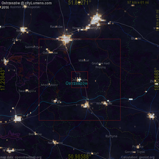
Analysis of Ostrzeszów night lights 2016
Square area 10x10 km:
 0.94%
0.94%90-99
1.2%80-89
0%70-79
1.07%60-69
0.53%50-59
0%40-49
0.8%30-39
0.8%20-29
0.53%10-19
0.53%0-9
93.58%Square area 50x50 km:
0.28%90-99
0.46%80-89
0.13%70-79
0.32%60-69
0.2%50-59
0.43%40-49
0.25%30-39
0.32%20-29
0.45%10-19
1.1%0-9
96.05%Clear (daylight) street map image can be seen on geolist.org.
Map coordinates:
51° 51' 45.8" North, 17° 13' 49.5" East
51° 25' 35" North, 17° 56' 0.8" East
50° 59' 9.2" North, 18° 38' 12" East
Some cities around Ostrzeszów sort by population:
• Kalisz
38.8 km =24.1 mi,  16°
16°
• Ostrów Wielkopolski
26.9 km =16.7 mi,  340°
340°
• Namysłów
41.6 km =25.8 mi,  200°
200°
• Kępno
16.9 km =10.5 mi,  166°
166°
• Syców
19.8 km =12.3 mi,  228°
228°
• Wieruszów
21.2 km =13.2 mi,  133°
133°
• Twardogóra
33 km =20.5 mi,  258°
258°
• Bierutów
43.1 km =26.8 mi,  218°
218°
3089670 (p: 14,446)
Sources (retrieved 2019-11-25):
» Earth at Night: Flat Maps 2012, 2016