Suchedniów night lights from space
Night Light of Suchedniów (Świętokrzyskie) from space (Poland) Src. Average luminocity for 10x10km area is 8.2981% and for 50x50km: 7.3706%.
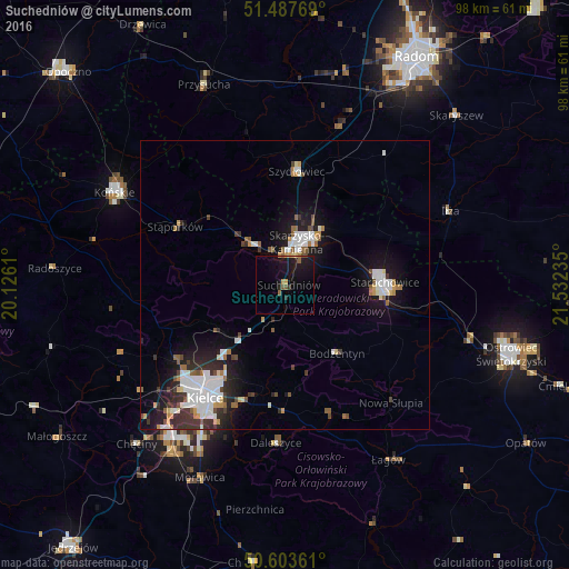
Analysis of Suchedniów night lights 2016
Square area 10x10 km:
 0%
0%90-99
0%80-89
0.53%70-79
1.87%60-69
0.4%50-59
1.74%40-49
1.07%30-39
0.4%20-29
2.01%10-19
16.84%0-9
75.13%Square area 50x50 km:
1.85%90-99
1.39%80-89
0.43%70-79
0.63%60-69
0.55%50-59
0.79%40-49
0.68%30-39
1.19%20-29
1.73%10-19
5.35%0-9
85.42%Clear (daylight) street map image can be seen on geolist.org.
Map coordinates:
51° 29' 15.7" North, 20° 7' 34" East
51° 2' 51.9" North, 20° 49' 45.2" East
50° 36' 13" North, 21° 31' 56.5" East
Some cities around Suchedniów sort by population:
• Kielce
24.3 km =15.1 mi,  215°
215°
• Starachowice
17 km =10.6 mi,  93°
93°
• Skarżysko-Kamienna
7.8 km =4.8 mi,  22°
22°
• Końskie
33.6 km =20.9 mi,  298°
298°
• Szydłowiec
20.2 km =12.6 mi,  6°
6°
• Przysucha
37.3 km =23.2 mi,  338°
338°
• Stąporków
20.6 km =12.8 mi, 299°
• Iłża
31.4 km =19.5 mi,  65°
65°
757886 (p: 9,184)
Sources (retrieved 2019-11-25):
» Earth at Night: Flat Maps 2012, 2016