Sobótka night lights from space
Night Light of Sobótka (Lower Silesia) from space (Poland) Src. Average luminocity for 10x10km area is 1.9216% and for 50x50km: 9.9288%.
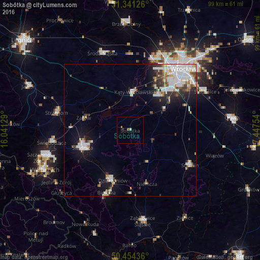
Analysis of Sobótka night lights 2016
Square area 10x10 km:
 0%
0%90-99
0.56%80-89
0%70-79
0%60-69
0.56%50-59
1.12%40-49
0%30-39
0.56%20-29
0%10-19
0%0-9
97.2%Square area 50x50 km:
2.75%90-99
2.5%80-89
0.74%70-79
0.71%60-69
0.75%50-59
0.82%40-49
1.02%30-39
1.11%20-29
1.76%10-19
4.7%0-9
83.13%Clear (daylight) street map image can be seen on geolist.org.
Map coordinates:
51° 20' 28.5" North, 16° 2' 28.6" East
50° 53' 59.7" North, 16° 44' 39.9" East
50° 27' 15.7" North, 17° 26' 51.1" East
Some cities around Sobótka sort by population:
• Świdnica
19 km =11.8 mi,  250°
250°
• Dzierżoniów
20.2 km =12.6 mi,  198°
198°
• Bielawa
24.8 km =15.4 mi, 200°
• Pieszyce
23.7 km =14.7 mi,  208°
208°
• Żarów
18.1 km =11.2 mi,  284°
284°
• Piława Górna
24.1 km =15 mi,  180°
180°
• Kąty Wrocławskie
14.7 km =9.1 mi,  6°
6°
• Jaworzyna Śląska
21.9 km =13.6 mi,  273°
273°
3085252 (p: 6,906)
Sources (retrieved 2019-11-25):
» Earth at Night: Flat Maps 2012, 2016