Piława Górna night lights from space
Night Light of Piława Górna (Lower Silesia) from space (Poland) Src. Average luminocity for 10x10km area is 3.1564% and for 50x50km: 3.6916%.
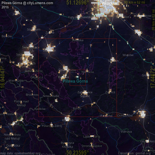
Analysis of Piława Górna night lights 2016
Square area 10x10 km:
 0%
0%90-99
1.07%80-89
0%70-79
0.53%60-69
0%50-59
0.13%40-49
0.94%30-39
0%20-29
0.53%10-19
0.13%0-9
96.66%Square area 50x50 km:
0.52%90-99
0.75%80-89
0.25%70-79
0.28%60-69
0.54%50-59
0.35%40-49
0.41%30-39
0.51%20-29
0.45%10-19
2.58%0-9
93.36%Clear (daylight) street map image can be seen on geolist.org.
Map coordinates:
51° 7' 37.1" North, 16° 2' 25.7" East
50° 41' 0.9" North, 16° 44' 36.9" East
50° 14' 9.4" North, 17° 26' 48.2" East
Some cities around Piława Górna sort by population:
• Dzierżoniów
8.2 km =5.1 mi,  307°
307°
• Bielawa
8.5 km =5.3 mi,  275°
275°
• Nowa Ruda
20.6 km =12.8 mi,  236°
236°
• Ząbkowice Śląskie
11.5 km =7.1 mi,  155°
155°
• Strzelin
25.1 km =15.6 mi,  64°
64°
• Pieszyce
11.8 km =7.3 mi,  286°
286°
• Ziębice
22.9 km =14.2 mi,  113°
113°
• Sobótka
24.1 km =15 mi,  0°
0°
3089025 (p: 6,736)
Sources (retrieved 2019-11-25):
» Earth at Night: Flat Maps 2012, 2016