Sokółka night lights from space
Night Light of Sokółka (Podlasie) from space (Poland) Src. Average luminocity for 10x10km area is 10.0079% and for 50x50km: 1.5279%.
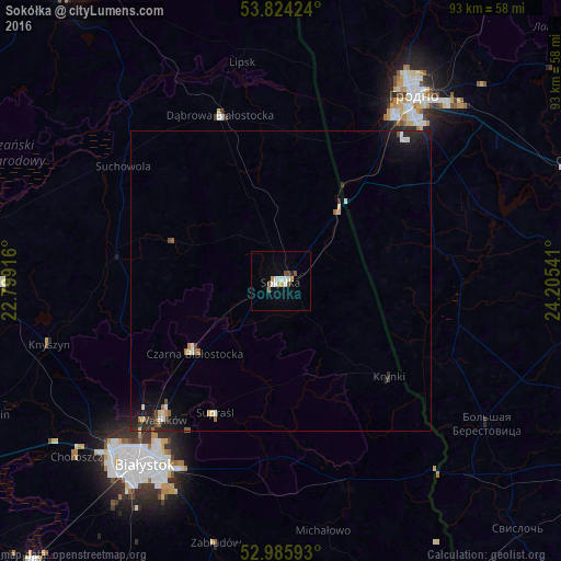
Analysis of Sokółka night lights 2016
Square area 10x10 km:
 2.12%
2.12%90-99
2.12%80-89
0.66%70-79
1.46%60-69
0.13%50-59
1.59%40-49
1.46%30-39
0%20-29
0.53%10-19
0.4%0-9
89.55%Square area 50x50 km:
0.18%90-99
0.25%80-89
0.12%70-79
0.13%60-69
0.16%50-59
0.22%40-49
0.14%30-39
0.14%20-29
0.45%10-19
1.23%0-9
96.97%Clear (daylight) street map image can be seen on geolist.org.
Map coordinates:
53° 49' 27.3" North, 22° 47' 57" East
53° 24' 25.7" North, 23° 30' 8.2" East
52° 59' 9.3" North, 24° 12' 19.5" East
Some cities around Sokółka sort by population:
• Hrodna, BY
37.9 km =23.5 mi,  34°
34°
• Białystok
37.8 km =23.5 mi,  216°
216°
• Czarna Białostocka
18.5 km =11.5 mi,  232°
232°
• Wasilków
30.3 km =18.8 mi, 220°
• Dąbrowa Białostocka
29.2 km =18.1 mi,  339°
339°
• Vyalikaya Byerastavitsa, BY
41.5 km =25.8 mi,  124°
124°
• Grudki
36.4 km =22.6 mi,  162°
162°
• Choroszcz
45 km =28 mi, 229°
758651 (p: 19,079)
Sources (retrieved 2019-11-25):
» Earth at Night: Flat Maps 2012, 2016