Wasilków night lights from space
Night Light of Wasilków (Podlasie) from space (Poland) Src. Average luminocity for 10x10km area is 28.2652% and for 50x50km: 6.3685%.
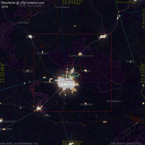
Analysis of Wasilków night lights 2016
Square area 10x10 km:
 4.92%
4.92%90-99
4.17%80-89
2.4%70-79
3.28%60-69
3.41%50-59
3.03%40-49
3.03%30-39
7.2%20-29
12.12%10-19
19.19%0-9
37.25%Square area 50x50 km:
1.65%90-99
1.5%80-89
0.5%70-79
0.52%60-69
0.56%50-59
0.4%40-49
0.52%30-39
0.85%20-29
1.81%10-19
3.15%0-9
88.54%Clear (daylight) street map image can be seen on geolist.org.
Map coordinates:
53° 37' 5.6" North, 22° 30' 16.7" East
53° 11' 56.7" North, 23° 12' 27.9" East
52° 46' 33" North, 23° 54' 39.2" East
Some cities around Wasilków sort by population:
• Białystok
7.9 km =4.9 mi,  201°
201°
• Bielsk Podlaski
48.3 km =30 mi,  181°
181°
• Sokółka
30.3 km =18.8 mi,  40°
40°
• Łapy
31.6 km =19.6 mi,  223°
223°
• Mońki
35.6 km =22.1 mi,  310°
310°
• Czarna Białostocka
12.8 km =8 mi,  22°
22°
• Grudki
32.8 km =20.4 mi,  110°
110°
• Choroszcz
15.9 km =9.9 mi,  246°
246°
756120 (p: 9,440)
Sources (retrieved 2019-11-25):
» Earth at Night: Flat Maps 2012, 2016